NX501/NZ501 English 16
Type Description
3D landmarks Landmarks are 3D artistic or block representations of prominent or well-known
objects.
3D buildings
3D block representation of full city building data containing actual building size and
position on the map.
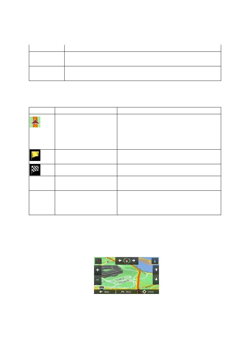
2.2.3.6 Elements of the active route
Clarion Mobile Map shows the route in the following way:
Symbol Name Description
Current GPS position and Start
point
Your current position displayed on the map. If roads are
near, it is aligned to the nearest road.
Normally if GPS position is available, the route
starts
from the current position. If there is no valid GPS
position, Clarion Mobile Map uses the last known
position as the start point.
Waypoint (intermediate
destination)
An intermediate destination of the route before reaching
the final destination.
Destination (end point) The final destination of the route.
Route color
The route always stands out with its color on the map,
both in daytime and in night color mode.
Streets and roads that are
excluded from the navigation
You can choose whether you want to use or avoid
certain road types (page 77). However, when Clarion
Mobile Map cannot avoid such roads, the route will
include them and it will show them in a color that is
different from the route color.
2.2.4 Manipulating t he map
Tap the map anywhere to browse it during navigation. The map stops following the current position (the
Vehimarker, a red arrow by default, is not locked in a fix position on the screen any more) and control
buttons appear to help you modify the map view.
 Loading...