EasyManua.ls Logo

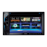
Clarion NX602

Clarion NX602
101 pages
To Next Page IconTo Next Page
Loading...
Owner's manual
NX602
Navigation

Table of Contents

Other manuals for Clarion NX602

Questions and Answers:

Clarion NX602 Specifications

General IconGeneral
Display Size6.2 inches
Resolution800 x 480 pixels
TouchscreenYes
NavigationYes
BluetoothYes
USB Ports1
DVD PlayerYes
Rear Camera InputYes
Audio Formats SupportedMP3, WMA, AAC
SD Card SlotYes
AUX InputYes
AM/FM RadioYes
Steering Wheel ControlYes
Power Output50W x 4
Video Formats SupportedMPEG-1, MPEG-2, DivX

Summary

Warnings and Safety Information

Getting Started with Clarion Mobile Map

2.1 Interface Controls Overview

Understanding the device's touch screen buttons, icons, lists, and radio buttons.

2.1.1 Using On-Screen Keyboards

How to input text and numbers using virtual keyboards and character switching.

2.1.2 Advanced Touch Interactions

Utilizing tap-and-hold, drag-and-drop gestures for enhanced functionality.

Map Screen Functionality

2.2.1 Navigating the Live Map

Viewing current position, route, and GPS signal status on the map.

2.2.2 Position Markers and Map Objects

Understanding Vehimarkers, cursors, and how map objects like streets are displayed.

2.2.3 Map Display Elements

Details on turn previews, lane information, junction views, and 3D object types.

2.2.4 Manipulating Map View

Zooming, tilting, rotating the map, and switching between 2D and 3D perspectives.

2.2.5 Quick Menu Access

Accessing frequently used functions and shortcuts via the Quick menu.

2.2.6 Current Position Details (Where Am I?)

Viewing detailed location data and searching for nearby assistance from the map.

Navigation Menu and Setup

2.3 Navigation Menu Options

Accessing core navigation functions like Find, My Route, and More.

On-Road Navigation Procedures

3.1 Selecting Your Destination

Methods for choosing a destination, including addresses and points of interest.

3.1.1 Entering Address Details

Step-by-step guides for entering addresses by country, street, or ZIP code.

3.1.2 Searching Points of Interest (POI)

Finding POIs like gas stations, restaurants, or accommodation by various search methods.

3.2 Viewing the Entire Route

Displaying the complete planned route on the map for an overview.

3.3 Route Parameters and Functions

Checking route details and accessing options like editing, bypassing, or cancelling.

3.4 Modifying the Active Route

Options to change the route, add waypoints, or set a new starting position.

3.5 Saving Locations as Favorites

Adding frequently visited locations to your Favorites list for quick access.

3.6 Saving Locations as Alert Points

Marking locations like speed cameras for audible or visual alerts.

3.8 Simulating Route Navigation

Running a simulated drive of your planned route to preview the journey.

Off-Road Navigation

4.1 Off-road Destination Selection

Selecting destinations for off-road navigation, linking points with straight lines.

4.2 Navigating in Off-road Mode

Understanding off-road navigation cues like compass bearing and distance.

Reference Guide and System Settings

5.1 Key Concepts Explained

Explanations of Smart Zoom, color themes, route calculation, and other key features.

5.3 System Settings Configuration

Configuring program settings like sound, voice, route, map, and display options.

Legal and Copyright Information

7 End User License Agreement

The legal terms and conditions for using the Clarion Mobile Map software.

8 Copyright Note

Information regarding product and manual copyright, proprietary data, and usage rights.

Related product manuals