RR400/420 User Manual - CRISARTECH
Firmware version 190122 - © CRISARTECH 2019 - Page 24 / 29
12 Recordings
This equipment records files during the race.
It can also record several files during scouting:
- GPS trace in two formats,
- correction waypoints for GPS auto-correction.
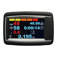
12.1 Regularity Tests recording
As soon as the stopwatch is triggered, a file is recorded into the internal flash disk. Its name is the start number, the
RT number, date and hour. The format is the following:
S 10
V 4500
P 14:26.0
0
44.7522823
4.2335585
0
…
P 14:39.7
17962
44.7514067
4.23258083
-74
G 4
M 42587
D 5
A -10
C 10
F 42697
First column is a label indicating the type of data:
- S: Start of RT, then the index of the RT. Here ZR10,
- V: speed imposed in 1/100 km/h. Each speed imposed changement is recorded. Here 45.00 km/h,
- F: the co-driver froze at this distance, in meters,
- D: GPS advise, in meters. Here the GPS advises to add 5 meters to Trip1,
- G: GPS auto-correction, in meter. Here GPS added 4 meters to Trip1,
- W: GPS auto-correction waypoint missed, then the index of the waypoint,
- M: manual set, in meter. Here the copilote set Trip1 to 42.587 km,
- A: manual (relative) adjustment. Here the copilote substracted 10 meters to Trip1,
- C: operation Cancel in meter. Here the copilote cancel the ‘-10 m’ so he added 10 meters,
- P: gps Position and more:
- time-stamp: Minute:Second.Tenth, here 14 minute and 39.7 seconds
- distance in meter, here 17.962 km,
- latitude in degrees, here 44.7514067° North (44°45'05.1"N),
- longitude in degrees, here 4.23258083 East (4°13'57.3"E),
- delay calculated by timer in 1/100 second, here 0.74 s. advance.
Remarque
: latitude longitude can be copy/pasted in GoogleMap (after removing « ; »).
The files are copied automatically in a USB drive when inserted, then archived (see later §).