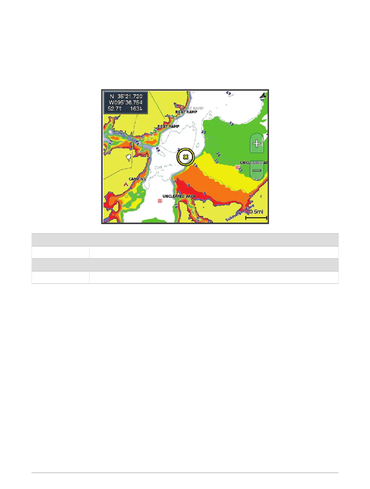
Depth Range Shading
You can set color ranges on your map to show the water depths where your target fish are currently biting. You
can set deeper ranges to monitor how quickly the bottom depth changes within a specific depth range. You can
create up to ten depth ranges. For inland fishing, a maximum of five depth ranges can help reduce map clutter.
The depth ranges apply to all charts and all bodies of water.
Some Garmin LakeVü
™
and premium supplemental charts have multiple depth range shading by default.
Red From 0 to 1.5 m (from 0 to 5 ft.)
Orange From 1.5 to 3 m (from 5 to 10 ft.)
Yellow From 3 to 4.5 m (from 10 to 15 ft.)
Green From 4.5 to 7.6 m (from 15 to 25 ft.)
To turn on and adjust, from a chart, select MENU > Layers > Water > Depth Shading.
22 Charts and 3D Chart Views

 Loading...