12 GPSMAP 640 Owner’s Manual
Marine Mode: Using Charts
Using Fish Eye 3D
Using the depth contour lines of the BlueChart g2 Vision
cartography, Fish Eye 3D provides an underwater view of the sea
oor or lake bottom. The and buttons adjust the view in the
same way as the Mariner’s Eye 3D.
To access the Fish Eye 3D screen from the Home screen, touch
Charts > Fish Eye 3D.
NOTE:
When navigating, the magenta line will not appear on the
Fish Eye 3D screen, though any enabled navigation data bars will
appear.
Using Fishing Charts
Use the shing chart to view detailed bottom contours and depth
soundings on the chart. There are no navigation aids such as buoys
and lights on the shing chart.
The shing chart uses highly detailed bathymetric data contained
on a preprogrammed BlueChart g2 Vision SD card, and is best for
offshore deep-sea shing.
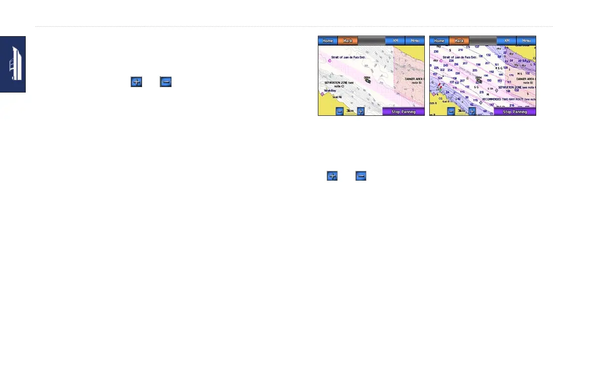
Navigation ChartFishing Chart
To access the Fishing chart screen from the Home screen, touch
Charts > Fishing Chart.
Touch and to zoom in and out on the Fishing chart.
You can navigate using the Fishing chart just as you would when
using the Navigation chart.
Enabling High�ResolutionHigh�Resolution Satellite
Imagery
You can overlay high-resolution satellite images on the land,
the sea, or both portions of the Navigation chart when using a
preprogrammed BlueChart g2 Vision SD card.