ADMA 3.0
USER MANUAL
Document Revision 2.01 | 2021 Page 83/137
10.5 Position information
10.5.1 WGS84 (World Geodetic System of 1984)
Polar coordinates (longitude, latitude, height above mean sea level) are used as a standard technique
of indicating positions for worldwide navigation. Most commercial GNSS receivers also output their
measured positions in this format.
Such position details are based on mathematical models of the earth, the WGS84 being the best
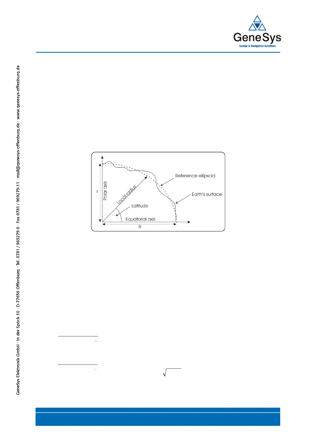
known and most common frame of reference among them. The WGS84 represents an ellipsoid
possessing rotational symmetry (see the illustration below).
The zero meridian (0° longitude) passes through Greenwich, England; 0° latitude is the equator.
The WGS84 model does not specify a height, but a location-dependent radius which follows an ellipse
function dependent on the degree of latitude.
Figure 62 WGS84
The local radius at the equatorial axis = R. As the degree of latitude increases, this radius changes
to approach a value = r at the poles.
The following values apply to calculations of the local radius Ro:
Large semi-axis: R = 6378137.0 m
Small semi-axis: r = 6356752.3142 m
Numeric eccentricity: e =0.0818191908426
Latitude: L
Radius of curvature - north RN
Radius of curvature - east RE
Local mean radius of curvature R0
where


 To Next Page