EZiSYSTEM, How to Use the Locator 25
Depth Indication
(i550, i650, i750, i550xf,
i650xf and i750xf)
• Activating Sonde depth will provide an inaccurate readout.
• Mark utilities with marker paint, pegs, flags or similar. Never drive pegs into the ground
over the service
• Additional services may be within the excavation zone, as well as the service you are
taking a depth reading from.
• The reading will be more accurate when taken over a straight run, where the service
does not bend, or have a service crossing it or coming off it.
• An additional depth reading should be taken with the locator lifted off the ground by
approximately 100 mm (4 inches). The reading obtained should confirm the addition of
this height.
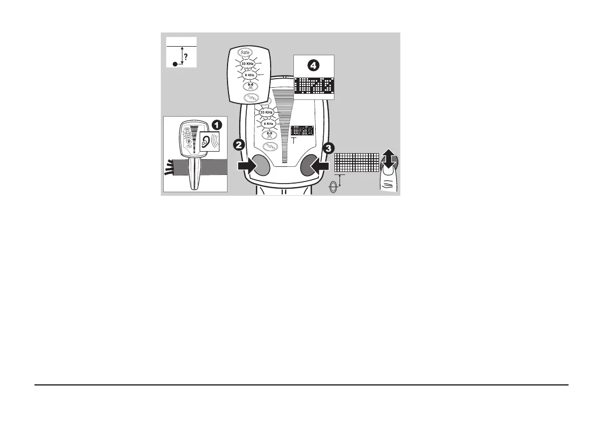
1. Apply a signal to the service.
Refer to "3 How to Use the
Transmitter" for more informa-
tion.
2. Select the mode to suit the
Transmitter’s output. Position
the Locator directly over, and
at 90 degrees to the direction
of the service.
3. Press and release the i Button.
4. The display readout will indi-
cate the depth of the service
and the Line mode icon will be
displayed.
i
F
i
 Loading...