54
55
EnglishEnglish
• Dawn and sunset time
• Moonrise and moonset time
• Moon phase
• Tide level graph (24 hours)
In the both cases above, the de-
fault date is today. A different
date can be set by pressing EN-
TER.
NOTE: The same information can be ac-
cessed by positioning the manual cursor on
the icon of a Tides or Currents station, and
pressing ENTER to confirm.
Goto
This function allows displaying, within the space of twenty-
four hours with respect to the selected date, the tide level and
tidal current speed and direction at a survey station in the
vicinity.
Unlike the estimated data shown in the Info window, this
forecast is much more accurate, being supplied directly by tidal
surveying stations.
Press GOTO, select NEAR by the CURSOR key, choose the Tides
or Currents service, then press ENTER to confirm. The GEONAV
will allow selecting one of the three nearest Tides and Cur-
rents stations. Use the CURSOR key to choose the station de-
sired and to confirm.
A window will show the information reported below.
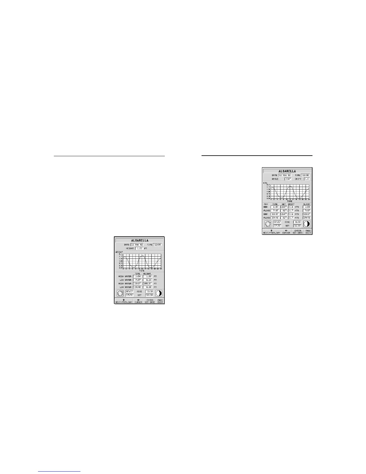
Tide station
• Name of the station
• Forecast reference date
• Time and height with respect
to the cursor’s position in the
graph
• Time and height of high/low
water
• Dawn and sunset time
• Moonrise and moonset time
• Moon phase
• Tide level graph (24 hours)
Tidal current station
• Name of the station
• Forecast reference date
• Time, speed and direction
with respect to the cursor’s
position in the graph
• Time, speed, direction and slack
time of daily flood and ebb streams