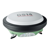
GR30/GM30/GR50, Technical Data
64
Accuracy in
differential phase
mode
1
Additional signals from modernised GNSS and a full constellation of emerging satel-
lites such as BeiDou and Galileo will further increase measurement performance and
accuracy.
2
Might vary due to atmospheric conditions, signal multipath, obstructions, signal
geometry and number of tracked signals.
Note: The mentioned accuracy values for post-processing are based on using the
LEICA Geo Office. Using specialist scientific software (Bernese) available from Leica
Geosystems, the following accuracies can be achieved in static post-processing mode,
even on very long baselines:
Accuracy (rms) with Post-Processing
1
Horizontal Vertical
Static (phase) with long
observations
3 mm + 0.1 ppm 3.5 mm + 0.4 ppm
Static and rapid static
(phase)
3 mm + 0.5 ppm 5 mm + 0.5 ppm
Kinematic (phase) 8 mm + 1 ppm 15 mm + 1 ppm
Accuracy (rms) with Real-Time (RTK)
1
Standard of compliance Compliance with ISO17123-8
Site Monitor Positioning
Modes
Reference Station Monitoring Network RTK
Rover
(Horizontal/Vertical) H V H V H V
Single Baseline (<30 km) 6 mm +
1 ppm
10 mm
+ 1 ppm
8 mm +
1 ppm
15mm +
1 ppm
8 mm +
1 ppm
15 mm +
1 ppm
Network RTK 6 mm +
0.5 ppm
10 mm +
0.5 ppm
8 mm +
0.5 ppm
15 mm +
0.5 ppm
8 mm +
0.5 ppm
15 mm +
0.5 ppm
Sampling Smoothed Instantaneous Instantaneous
On-the-fly (OTF) initialisation
RTK technology Leica SmartCheck technology
Reliability of OTF
initialisation1)
≥ 99.999% ≥ 99.999% ≥ 99.99%
Time for initialisation
(typically)
2
10 seconds 10 seconds 4 seconds
OTF range
2
Up to 80 km Up to 70 km Up to 70 km
Network RTK
Network technology Leica SmartRTK technology
Supported RTK network
solutions
VRS, FKP, i-MAX
Supported RTK network
standards
MAC (Master Auxiliary Concept) approved by RTCM SC104
• 2 - 4 mm in plan • 3 - 6 mm in height
 Loading...