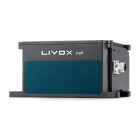
LIVOX HAP
User Manual
©
2022 Livox Tech All Rights Reserved.
15
Point Cloud Data
A point cloud is the collection of the points where the surface of an object was detected in the
FOV of the LiDAR sensor. Each point contains the following information.
Target reectivity: 0 to 150 corresponds to the reectivity within the range of 0 to 100% in the
Lambertian reflection model. 151 to 255 corresponds to the reflectivity of target objects with
retroection properties.
Coordinates: Can be expressed as Cartesian coordinates (x, y, z). When there is no object within
the detection range or the object is placed beyond the detection range, the coordinates of the
point cloud will be expressed as (0, 0, 0) in Cartesian coordinates.
Tags: Indicates the return type of the laser and if the point detected is a noise. The format of the
tag is as shown below:
bit7 bit6 Bit5 Bit4 Bit3 Bit2 Bit1 Bit0
Reserved Return Number:
00: Return 0
01: Return 1
10: Return 2
11: Reserved
Point property based on
intensity:
00: Normal
01: Noise that does not
meet intensity expectation
10: Reserved
11: Reserved
Point property based on
spatial position:
00: Normal
01: High confidence level
of noise
10: Moderate confidence
level of noise
11: Low confidence level
of noise
Each tag is composed of one byte. In this byte, bit7 and bit6 are Group 1, bit5 and bit4 are Group
2, bit3 and bit2 are Group 3 while bit1 and bit0 are Group 4.
Group 2 indicates the return sequence of the sampling point. Featuring a coaxial optical path, the
HAP (TX) LiDAR sensor will generate a laser return even if there is no detectable object around.
The return is recorded as return 0. After that, if there is any object within the detectable range, the
rst laser that returns to the HAP (TX) is recorded as return 1, and then return 2, and so on. If the
object is too close to the HAP (TX), such as 1.5 m away, the rst eective return will be merged
into return 0, and be recorded as return 0.
Group 3 indicates if the sampling point is noise based on the intensity of the return. Normally, the
intensity of the returns of the noises generated due to the interference of atmospheric particles
such as dust, rain, fog, and snow is relatively low. Therefore, noise is divided into two categories
based on the intensity of the return received: "01" represents a low-intensity return, indicating
that the samples have a high possibility of being noise such as dust; “10” represents a moderate
intensity return, indicating that the samples have a moderate possibility of being noise such as
rain and fog. The lower the noise condence level, the lower the possibility that it is a noise.
Group 4 indicates if the sampling point is noise based on its spatial position. Normally, when the
HAP (TX) LiDAR sensors detect two objects in close proximity of each other, there will be some
thread-like noise between the two objects.