P22 Latitude
Vessels current Latitude as calculated by the GPS Antenna.
P23 Longitude
Vessels current Longitude as calculated by the GPS
Antenna.
P24 Bearing to Waypoint
Bearing To (active) Waypoint. The active Waypoint being the
one to which the GPS is currently navigating.
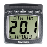
P25 Distance to Waypoint
Distance To (active) Waypoint. The active Waypoint being the
one to which the GPS is currently navigating. When the
Waypoint has been named in the GPS the name will be
displayed (first five digits only).
P26 Cross Track Error
Cross Track Error as defined by the GPS Antenna.
P27 Time to Go to Waypoint
The time remaining before you will arrive at the (active)
waypoint as calculated by a GPS receiver or plotter.
P28 Sea Temperature
Current Sea Temperature as measured by the sensor in the
Speed Transducer.
Operation
15
 Loading...