Do you have a question about the Raymarine C140w and is the answer not in the manual?
Crucial safety warnings for product operation and environment.
Details on display technology, water resistance, and product limitations.
Information on memory cards, EMC, and conformity.
Guidelines on disposal, warranty, and manual accuracy.
Overview of the handbook's scope and compatible C-Series display models.
Details the manual's content, assumptions, and peripheral compatibility.
Details system integration and connectivity options for external devices.
Explains controls, navigation, and menu interaction.
Guides users through initial setup tasks like language, date, and lighting.
Details the uses of CompactFlash cards for data storage and cartography.
Instructions for saving, retrieving, and erasing data to/from CF cards.
Explains PC data transfer and operating networked systems.
Methods for placing waypoints at cursor, vessel, or known positions.
Steps to view, sort, and navigate to waypoints.
Instructions for editing waypoint details and securing them with a password.
Explains the capabilities of the chart application for navigation and data interpretation.
Emphasizes safe navigation practices and the role of official charts.
Details chart configuration and navigation methods like panning and zooming.
Explains chart orientation, motion modes, and presentation options.
Provides an overview of 3D chart capabilities for visualization and navigation.
Details 3D chart configuration and viewing modes.
Guides on navigating, viewing, and interacting with 3D charts.
Explains autopilot control functions and emergency disengagement.
Details autopilot status indicators and available control options.
Explains how autopilot alarms are displayed, triggered, and silenced.
Introduces radar principles and scanner power status.
Discusses range limits, image quality factors, and radar screen elements.
Guides on adjusting gain, clutter, and tune for digital radar scanners.
Instructions for tuning analog radar using various functions.
Explains AIS functionality, data broadcasting, and collision avoidance.
Lists requirements for AIS and categorizes AIS data types.
Guides on displaying AIS vectors, targets, and detailed information.
Covers safe zones, alarms, and tracking friends via AIS.
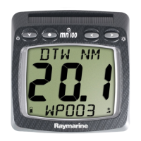
Introduces the Course Deviation Indicator (CDI) and its graphical representation.
Guides on adding and using the CDI for course monitoring and navigation.
Instructions for customizing the data elements displayed in the CDI application.
Basics of fishfinder operation and interpreting sonar images.
Details preset configurations and display modes like Zoom and Bottom Lock.
Covers adjusting range, gain, color, and other presentation settings.
Guides on configuring alarms, frequencies, and transducer settings.
Explains the engine monitor application and how to display it.
Guides on configuring and customizing the engine monitor display.
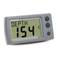
Explains that the data application displays system and instrument data.
Lists and explains default data panels and how to select them.
Guides on customizing panel names, size, and data content.
Explains weather app functionality and initial setup requirements.
Details weather graphics, symbols, and map navigation.
Explains how to view weather reports and monitor storm tracks.
Describes how to view animated graphics for forecast and radar history.
Explains Sirius radio functionality and basic operations like tuning and scanning.
Guides on setting up presets and song/artist alerts for Sirius radio.
Details how to block channels and set up a parental lock with a password.
Explains Navtex functionality and setup requirements for receiving alerts.
Instructions for viewing, sorting, and managing Navtex messages and alert categories.
Explains viewing video or camera sources directly connected to the display.
Guides on adding video to a page and adjusting aspect ratio.
Instructions for adjusting video picture settings like brightness, contrast, and color.
Explains connecting a DSC VHF radio to display distress messages and GPS position data.
Guides on configuring the multifunction display to show messages from a DSC VHF radio.
Explains how to customize page sets by changing applications and layouts.
Guides on moving, resizing, and changing the data displayed in the databar.
Emphasizes authorized servicing, safety, and regular equipment checks.
Provides guidance on cleaning the display and performing factory resets.
Provides web and telephone contact information for Raymarine technical support.
Lists websites for Sirius services and Navionics chart support.
| Display Size | 14 inches |
|---|---|
| Display Resolution | 1280 x 800 pixels |
| Waterproof Rating | IPX6 |
| Operating Voltage | 12/24 V DC |
| Contrast Ratio | 800:1 |
| Touchscreen | Yes |
| Display Type | TFT LCD |
| Brightness | 1000 nits |
| Video Input | Composite video |
| Operating Temperature | -15°C to +55°C |
| Storage Temperature | -30 to +70 °C |