Parameter Track Image Zone
Flight time Flight distance Flights
Footprint
Visit 0 districts
Max mileage 0.0 m
Max altitude 0.0 m
Max speed 0.0 m/s
0.0 min 0.0 m 0
All flight records
Find drone
Log
Beginner Mode
Default open for novice mode close for custom mode
Flight distance
default30m,(20-3500m)
default30m,(10-120m)
default20m,(10-120m)
30 m
30 m
20 m
Flight altitude
Return altitude
Note: return altitude shall not exceed flight altitude
Parameter Track Image PTZ Adiust Zone
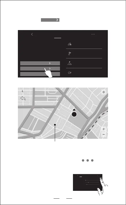
①.Continue to click to open the MAP surface to search
the aircraft.
4. HOW TO SEARCH THE LOST DRONE
②.The last position of lost aircraft will be appeared on the MAP.
Current position of the mobile phone
Flight System
Setting
5. FLIGHT
The Default GPS Mode is BEGINNER MODE:
1.Flight Distance is between 0-30 M.
2.Flight Altitude is between 0-30 M.
3.RTH Altitude is under 20 M.
You can Turn-off the BEGINNER MODE to
set the parameters in the APP from the
smart phone.
Find drone
18