radar returns.
Table 5.5-1.Radar Display and Thunderstorm Levels
versus Rainfall Rates
Video Integrated Processor (VIP)
Categorizations
Rainfall Rate
Rainfall Rate
Display
Level
mm/Hr. In./Hr
Story
Category
VIP
Level
mm/Hr. In./Hr.
Remarks
3
(Red)
12 0.5 Strong 3
Greater
than 12
Greater
than 0.5
Severe turbulence,
possible lightning
2
(Yellow)
4-12 0.17-0.5 Moderate 2 2.5-12 0.1-0.5
Light to moderate
turbulence is
possible with
lightning
1
(Green
1-4 0.04-0.17 Weak 1 0.25-2.5 .01-0.1
Light to moderate
turbulence is
possible with
lightning
0
(Black)
Less
than 1
Less than
0.04
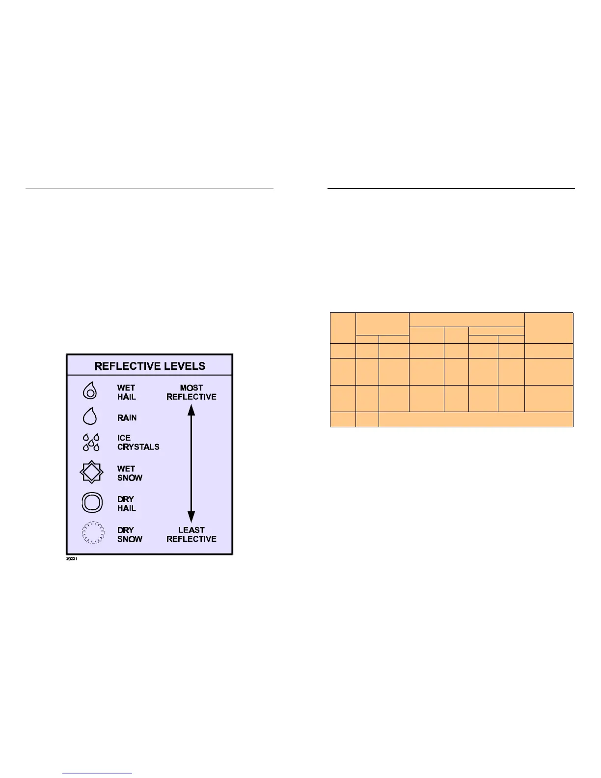
5.4RADAR REFLECTIVITY
What target will reflect the radar’s pulses and thus be displayed on the
indicator?
Only precipitation (or objects more dense than water such as earth or solid
structures) will be detected by an X-band weather radar. Therefore,
weather radar does not detect clouds, thunderstorms or turbulence direct-
ly. Instead, it detects precipitation which may be associated with dangerous
thunderstorms and turbulence. The best radar reflectors are raindrops and
wet hail. The larger the raindrop, the better it reflects. Because large drops
in a small concentrated area are characteristic of a severe thunderstorm,
the radar displays the storm as a strong echo. Drop size is the most impor-
tant factor in high radar reflectivity. Generally, ice, dry snow and dry hail
have low reflective levels and often will not be displayed by the radar.
A cloud that contains only small raindrops, such a fog or drizzle, will not pro-
duce a measurable radar echo. But if the conditions should change and the
cloud begins to produce rain, it will be displayed on radar.
Figure 5.4-1.Reflective Levels