Instrument operation
51
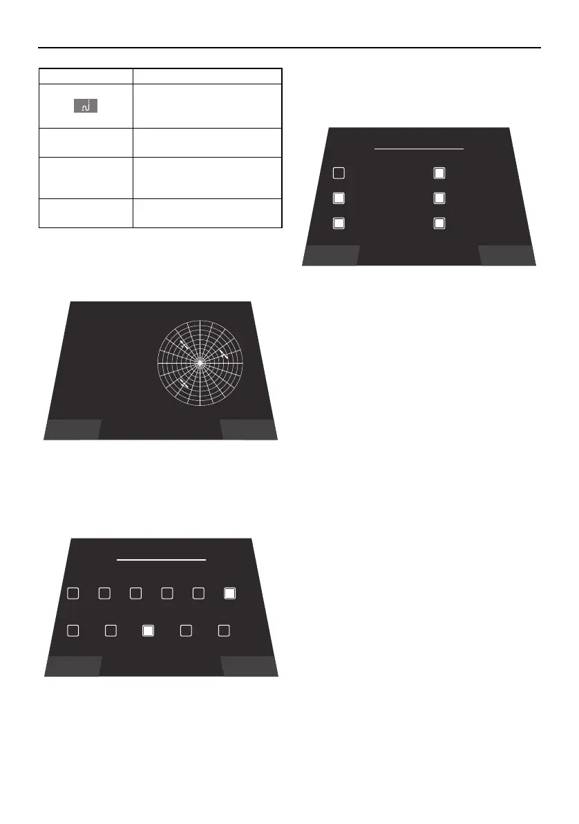
Satellite status
Display detectable satellites.
Depth / Position
Perform settings for contour lines and safe
depths.
To perform settings, select the desired depth.
Set depths are reflected on the map.
Chart Setup
Perform settings for functions displayed on
the map.
To perform settings, select the item you want
to display.
Item Function
Changes the color of the
track.
EDIT Changes the name of, or
deletes, the track.
Show / Hide Shows the track on the
map. Hide will make that
track invisible.
Close Returns to the Track Man-
ager screen.
Close
SATELLITES
3
9:47
Latitude: 35.6060
Longitude: -84.2541
Op Mode: 0.00
HDOP: 0.00
VDOP: 0.00
TDOP: 0.00
SOG: 0.0
COG: 0
N
WE
S
Satallite Status
Close
Depth / Position
DEPTH CONTOUR
SAFETY CONTOUR
All 66ft
33ft 16ft 6ft 0ft
66ft 33ft
16ft 6ft 0ft
Close
Chart Setup
SHOW GRIDS SHOW TRACKS
SHOW NAV AIDSSHOW TEXT
SHOW WAYPOINT NAMESSHOW WAYPOINTS
SportsBoat_F5K10.book Page 51 Tuesday, September 8, 2020 11:29 AM
Downloaded from ManualsNet.com search engine