NX702E English 53
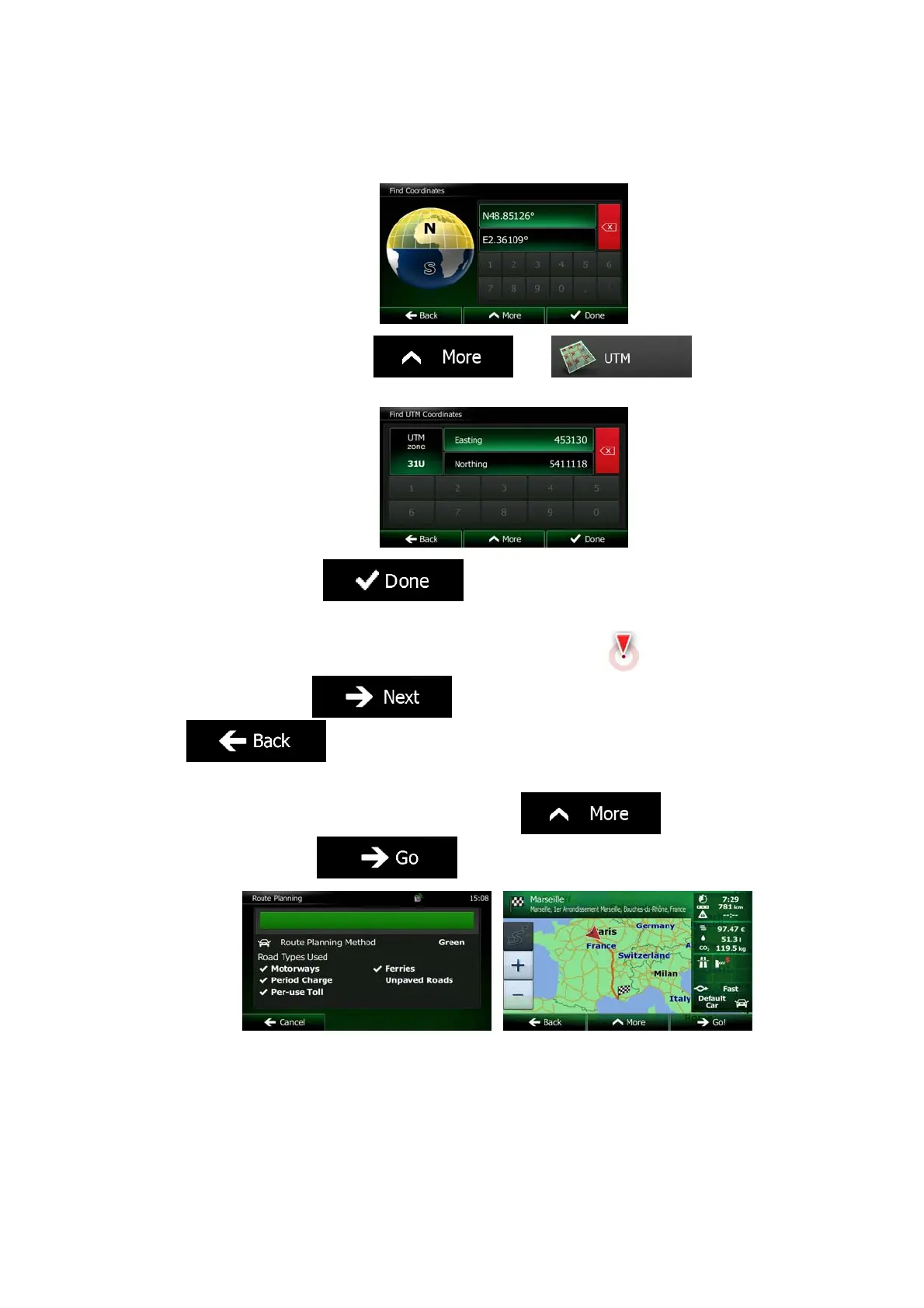
4. You can enter the latitude and longitude values in any of the following formats: decimal
degrees; degrees and decimal minutes; or degrees, minutes and decimal seconds.
5. (optional) If necessary, tap
then and enter
the coordinate in UTM format.
6. When finished, tap
.
7. A full screen map appears with the selected point in the middle. If necessary, tap the
map somewhere else to modify the destination. The Cursor (
) appears at the
new location. Tap
to confirm the destination, or tap
to select a different destination.
8. After a short summary of the route parameters, the map appears showing the entire
route. The route is automatically calculated. Tap
to modify route
parameters, or tap
and start your journey.
 Loading...