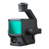
http://www.dji.com/zenmuse-l1
Copyright © 2022 DJI All Rights Reserved.
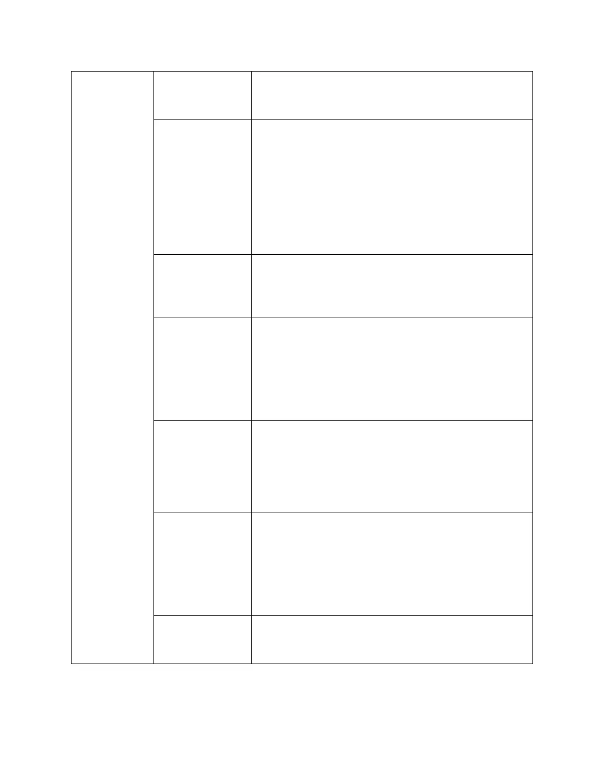
20
This indicates the number of points per square meter.
It is related to parameters such as flight altitude,
overlap ratio, flight speed, scan mode. As a core
indicator of the data output, point cloud density should
be determined first based on the project requirements.
Then the flight speed and other parameters should be
set based on it.
Relative to takeoff point (ALT) is usually selected by
default.
ASL (EGM96) could be selected if you need to plan the
mission with EGM96 altitude.
The recommended flight altitude is 50~100 meters.
When the ground object's reflectivity is 10%, the L1's
measurable distance is 190 meters. The flight altitude
should not exceed 150 meters to avoid data loss.
Target
Surface to
Takeoff Point
0 by default.
This value can be adjusted in case there is an elevation
difference between the target surface and takeoff
point.