http://www.dji.com/zenmuse-l1
Copyright © 2022 DJI All Rights Reserved.
25
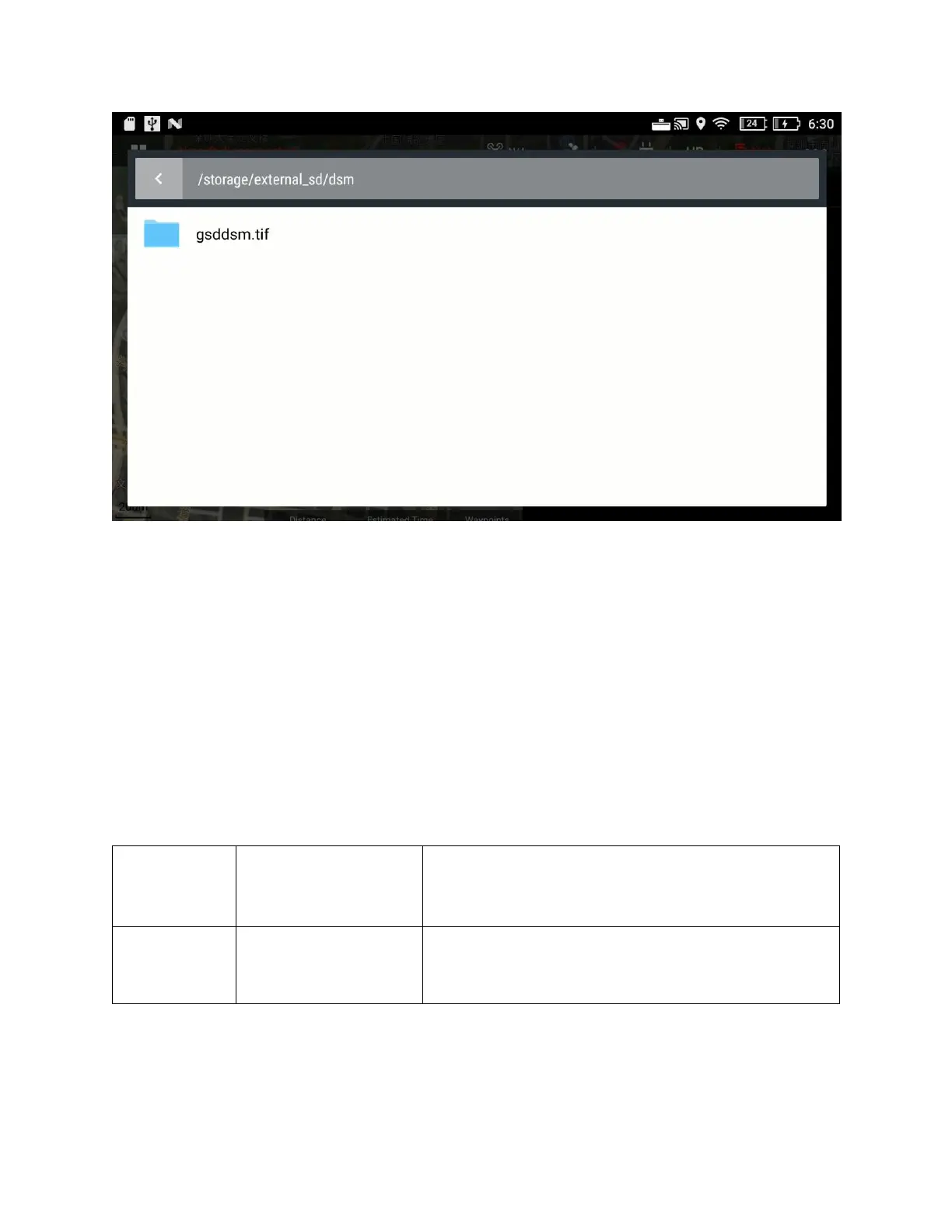
Figure: Select the DSM file in the SD card
You can see the area covered by the DSM file on the map now. Then you can plan the survey area
within this area.
Terrain Follow is recommended when the elevation difference of the survey area is greater than 100
meters.
3.4.2 Riverbank / Road Surveying
When the survey area is a narrow strip of land such as roads, railways, riverbanks, etc., Linear Flight
Mode can be used for L1 mission planning.