EasyManua.ls Logo

Furuno GP-1670 User Manual

Furuno GP-1670
143 pages
To Next Page IconTo Next Page
Page #1 background imageLoading...
Page #1 background image
GP-1670/GP-1870
OPERATOR'S MANUAL
www.furuno.com
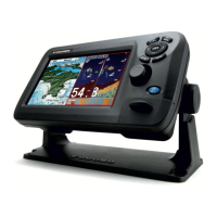
GPS PLOTTER
Model

Table of Contents

Questions and Answers:

Furuno GP-1670 Specifications

General IconGeneral
Display Size7 inches
Display TypeTFT Color LCD
Resolution800 x 480 pixels
WAASYes
Waterproof RatingIPX7

Summary

IMPORTANT NOTICES

General Information and Disposal

Important general statements, guidelines for manual use, and product disposal instructions.

SAFETY INSTRUCTIONS

Warnings and Cautions

Crucial safety information regarding electrical shock, modification, operation, and handling hazards.

FOREWORD

Welcome and Features Overview

Introduction to the product and a summary of its main features and capabilities.

SYSTEM CONFIGURATION

Unit Specifications and Diagrams

Details environmental categories and illustrates system configurations for GP-1670/GP-1870.

EQUIPMENT LISTS

Standard and Optional Components

Lists all standard and optional components included or available for the unit.

OPERATIONAL OVERVIEW

1.1 Controls

Explains the physical controls and their functions on the unit.

1.2 RotoKeyTM and Soft Controls

Details the operation and functionality of the RotoKey and soft controls.

1.3 Power and Display Adjustment

Instructions for turning the unit on/off and adjusting screen brightness.

1.5 2D Plotter Displays

Overview of the 2D plotter display features and capabilities.

1.6 The Cursor

Explains how to use and interpret the cursor on the display.

1.7 Navigation Data Boxes

Describes how to display and customize navigation data in screen boxes.

1.8 Home Screen Display Selection

Guide to selecting and switching between different home screen displays.

1.9 Display Range and Orientation

How to adjust chart scale and chart orientation settings.

1.10 Menu Operation

Instructions on navigating and operating the system menus.

1.11 Object Information

How to view detailed information about points, tracks, and chart objects.

1.12 Context-Sensitive Menus

Explains how context-sensitive menus provide quick access to related functions.

1.13 Man Overboard (MOB)

Procedures for marking and managing man overboard situations.

1.14 Taking Screenshots

Instructions for capturing and saving screen images.

1.15 Tide Information

How to access and view tide height and tidal current data.

TRACK

2.1-2.3 Track Operations

Managing track display, recording, and selection methods.

2.4-2.6 Track Display Customization

Changing track color, using temperature-based coloring, and managing visibility.

2.7-2.8 Track Deletion and Information

How to delete tracks by color and retrieve track data.

POINTS

3.1 What is a Point?

Definition and purpose of points (waypoints) in navigation.

3.2 Entering Points

Procedures for marking and saving points on the plotter.

3.3-3.4 Point Information and Movement

How to view point details and reposition points on the screen or list.

3.5-3.6 Point Visibility, Search and Sort

Managing point visibility, finding, and organizing points in the list.

3.7-3.8 Point Filtering and Deletion

Filtering points by shape and methods for deleting points.

ROUTES

4.1 What is a Route?

Definition and storage capacity for routes and waypoints.

4.2 Creating Routes

Procedures for creating routes using soft controls or the Routes List.

4.2.3 Easy Routing Feature

Using the Easy Routing function to automatically plan safe routes.

4.3 Extending and Inserting Route Points

How to extend routes and insert points between route legs.

4.4-4.6 Moving and Deleting Route Points

Methods to reposition or remove points within an existing route.

4.7 Routes List

How to display and manage saved routes.

4.8 Route Report and Calculator

Accessing route details and using the route navigation calculator.

4.9-4.10 Displaying and Connecting Routes

Plotting routes on screen and linking multiple routes together.

4.11-4.13 Route Information, Renaming, and Deletion

Viewing route info, renaming routes, and deleting routes.

NAVIGATION

5.1 Navigate to a Quick Point

How to navigate to a temporary point at the cursor position.

5.2 Navigate to a Saved Point

Procedures for navigating to saved points from the screen or list.

5.3 Select a Route for Navigation

How to choose a route for active navigation.

5.4 Route Navigation Functions

Managing active navigation, including restart, reverse, stop, and skip.

MAP SETTINGS, 2D PERSPECTIVE/3D DISPLAYS AND SATELLITE OVERLAY

6.1 Map Setup

Configuring basic map display settings like icons, language, and units.

6.2 Chart Display Settings

Adjusting chart overlays, display modes (2D, 3D), and transparency.

6.3 3D Display

Detailed description and operation of the 3D chart view.

6.4 Satellite Photo Overlay

How to overlay satellite imagery onto the chart display.

ALARMS

7.1 ALARMS Menu

Overview of the alarms menu and available alarm conditions.

7.2 Audio Alarm Conditions

How to enable/disable audio alarms and set their interval.

7.3 Arrival Alarm

Setting up the alarm that triggers when approaching a destination waypoint.

7.4 XTE Alarm

Configuring the cross-track error alarm for off-course deviations.

7.5 Temperature Alarm

Setting up alarms for water temperature variations.

7.6 Shear Alarm

Setting up alarms for exceeding temperature thresholds.

7.7 Depth Alarm

Configuring the alarm for water depth conditions.

7.8 Anchor Alarm

Setting up the alarm for boat movement while at anchor.

7.9 Trip Alarm

Configuring alarms based on distance traveled.

7.10 Speed Alarm

Setting up alarms for exceeding or falling below set speed limits.

7.11-7.13 Tank Alarms

Setting up alarms for fuel, water, and black water tank levels.

MEMORY CARD OPERATIONS

8.1 Memory Card Screen and Initialization

Overview of memory card interface and steps to initialize SD cards.

8.2-8.3 SD Card Management

Procedures for ejecting SD cards and saving/renaming files.

8.4 Deleting and Importing SD Card Data

How to remove files and transfer data between SD card and internal memory.

8.5 Screenshot Processing

Managing screenshots, including saving, deleting, and previewing.

OTHER FUNCTIONS

9.1 AIS Operations

Overview of the Automatic Identification System and its data.

9.1.2-9.1.4 AIS Information and Alarms

Finding AIS target details and configuring CPA/TCPA alarms.

9.2 DSC Message Information

Handling Digital Selective Calling messages and alerts.

9.3 Stopwatch and Timer

Using the built-in stopwatch and timer functions.

9.4 Input/Output Data Selection

Configuring data sources and outputs for external equipment.

9.5 Engine Display Setup

Configuring engine parameters for display on the unit.

CUSTOMIZING YOUR UNIT

10.1 GENERAL Menu

Customizing general settings like keypad beep, palette, font size, and time/date.

10.2 PLOTTER Menu

Customizing plotter-specific settings like COG line, heading line, and ship icon.

10.3 SYSTEM Menu

Configuring system-wide settings like language, units, and GPS.

MAINTENANCE, TROUBLESHOOTING

11.1 Maintenance

Routine checks and tasks to maintain the equipment's performance.

11.2 Fuse Replacement

Step-by-step guide for safely replacing a blown fuse.

11.3 Troubleshooting

Common problems and their solutions for restoring normal operation.

11.4 GPS Status Display

Understanding the GPS status display for satellite reception and position accuracy.

11.5 Restore Defaults, Clear Memory

How to reset settings to factory defaults or clear user data.

11.6 System Information

Viewing system details, license information, and data access reports.

INSTALLATION

12.1 Display Unit Installation

Procedures and considerations for mounting the display unit.

12.2 Antenna Unit Installation

Mounting considerations and procedures for the GPS antenna unit.

12.3 Wiring

Instructions for connecting power, antenna, transducer, and other cables.

12.4 Initial Settings

Basic setup procedures upon first powering the system.

12.4.2 CAN bus Input/Output

Configuring data input and output for CAN bus devices.

APPENDIX 1 MENU TREE

Menu Structure Overview

Provides a hierarchical view of the system's menu options and sub-options.

APPENDIX 2 ABBREVIATIONS, SYMBOLS

Abbreviations List

List of abbreviations used in the manual and their meanings.

Symbols Guide

Visual representations of symbols used in plotter displays and alarms.

APPENDIX 3 JIS CABLE GUIDE

JIS Cable Identification

Reference for identifying and understanding JIS cable specifications.

SPECIFICATIONS OF GPS PLOTTER GP-1670/1870

1. General Specifications

General specifications including display, projection, and language support.

2. GPS Receiver Specifications

Details of the GPS receiver's performance and capabilities.

3. Plotter Function Specifications

Specifications related to plotter functions like SD card and memory capacity.

4. Interface Specifications

Specifications for data input/output ports and formats.

5. Power Supply Specifications

Electrical specifications for the display unit and rectifier.

6. Environmental Conditions

Operating temperature, humidity, and protection ratings.

PACKING LIST

GP-1670 Packing List

List of items included in the GP-1670 package.

GP-1870 Packing List

List of items included in the GP-1870 package.

OUTLINE DRAWINGS

GP-1670 Outline Drawings

Technical drawings showing dimensions and mounting details for GP-1670.

GP-1870 Outline Drawings

Technical drawings showing dimensions and mounting details for GP-1870.

INTERCONNECTION DIAGRAM

GPS Plotter Interconnection Diagram

Diagram illustrating how different units connect to form the system.

FURUNO Worldwide Warranty

Warranty Terms and Limitations

Details warranty period, scope, requirements, exclusions, and limitations.

FURUNO Warranty for North America

Warranty Registration and Service

Information on registering products and obtaining warranty service.

Declaration of Conformity

GPS Plotter Compliance Statements

Statements of compliance with EU directives for radio and telecommunications.

Related product manuals