Garmin aera 795/796 Pilot’s Guide
190-01194-00 Rev. C
88
Hazard Avoidance
OverviewGPS NavigationFlight PlanningHazard AvoidanceAdditional FeaturesAppendicesIndex
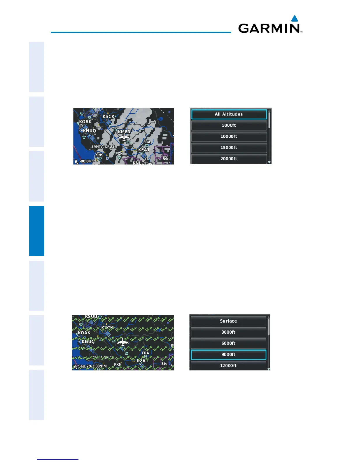
ECHO TOPS
Echo Tops are derived from NEXRAD radar and indicate the highest altitude at which
precipitation is falling. Echo Tops at or above the altitude you select are displayed, in
5,000 foot increments up to 70,000 ft. Echo Tops can be helpful in determining the
severity of thunderstorms.
Echo Tops Data Echo Tops Altitudes
WINDS ALOFT
Winds Aloft data shows the forecasted wind speed and direction at the surface
and at selected altitudes. Altitudes can be displayed in 3,000-foot increments up to
42,000 feet MSL.
Winds Aloft are displayed using wind barbs or a wind streamline depending on
the selected range. The wind barbs indicate wind speed and direction. The wind
streamline indicates wind direction with arrows.
The wind barbs always point in the direction that the wind is coming from. The wind
speed is depicted using flags at the end of the wind barb. A short wind flag is 5 knots,
a long wind flag is 10 knots, and a triangle flag is 50 knots.
Winds Aloft Data Winds Aloft Altitudes

 Loading...