Garmin G1000 Pilot’s Guide for the Diamond DA42NG
190-00-00962-02 Rev. A
396
HAZARD AVOIDANCE
SYSTEM
OVERVIEW
FLIGHT
INSTRUMENTS
EIS
AUDIO PANEL
& CNS
FLIGHT
MANAGEMENT
HAZARD
AVOIDANCE
AFCS
ADDITIONAL
FEATURES
APPENDICESINDEX
TheMap-Terrain-SVSPageistheprincipalpageforviewingterrainandobstacleinformation.Terrain-SVS
informationcanalsobedisplayedonthefollowingpagesandmapsasanadditionalreference:
•PFDInsetMap
•NavigationMapPage
•TripPlanningPage
•FlightPlanPages
•AUX-VideoPage
Displaying terrain and obstacle information (maps other than the Terrain-SVS Page):
1) Press the MAP Softkey (for the PFD Inset Map, select the INSET Softkey).
2) Press the TERRAIN Softkey to display terrain and obstacle data.
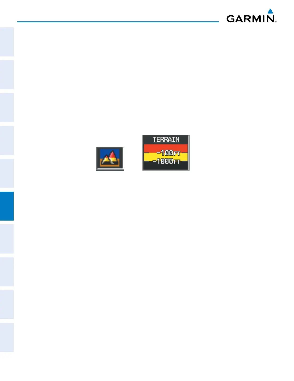
WhenTerrain-SVSisselectedonmapsotherthantheTerrain-SVSPage,anicontoindicatethefeatureis
enabledfordisplayandalegendforTerrain-SVSterraincolorsareshown(Figure6-148).
Figure 6-148 Terrain-SVS Icon and Legend
TheNavigationMapPageSetupMenuprovidesameansinadditiontothesoftkeyforenabling/disabling
displayofterrainandobstacles.Thesetupmenualsocontrolsthemaprangesettingsabovewhichterrainand
obstacledataaredeclutteredfromthedisplay.Ifamaprangelargerthanthemaprangesettingisselected,the
dataisremovedfromthemap.Forterraindata,theenable/disablefunctionappliesonlytotheMFD,whilethe
rangesettingalsoaffectsthePFDInsetMap.
Terraindatacanbeselectedfordisplayindependentlyofobstacledata;however,obstaclesforwhichwarnings
and cautions are issued are shown when terrain is selected for display and the map range is within the setting
limit.
MapsbesidestheTerrain-SVSPageusesettingsbasedonthoseselectedfortheNavigationMapPage.The
maximumdisplayrangesforobstaclesoneachmaparedependentontherangesettingmadefortheNavigation
Map.IfthemaximumrangeforobstacledisplayontheNavigationMapisadjustedtobelow20nm,thehighest
obstacledisplayrangesettingsontheotherapplicablemapsarealsoadjustedproportionally.
Customizing terrain and obstacle display on the Navigation Map Page:
1) Select the Navigation Map Page.
2) Press the MENU Key.
3) With ‘Map Setup’ highlighted, press the
ENT
Key (Figure 6-149).
4) Turn the small FMS Knob to select the ‘Map’ Group and press the ENT Key (Figure 6-150).
5) Turn the large
FMS
Knob or press the
ENT
Key to scroll through product selections (Figure 6-151).
•TERRAIN DATA – Turns the display of terrain data on or off and sets maximum range at which terrain is shown
•OBSTACLE DATA – Turns the display of obstacle data on or off and sets maximum range at which obstacles are shown

 Loading...


