34 GPSMAP 76CSx – Guide de l’utilisateur
FonctIonnement de base > créatIon et utIlIsatIon d’ItInéraIres
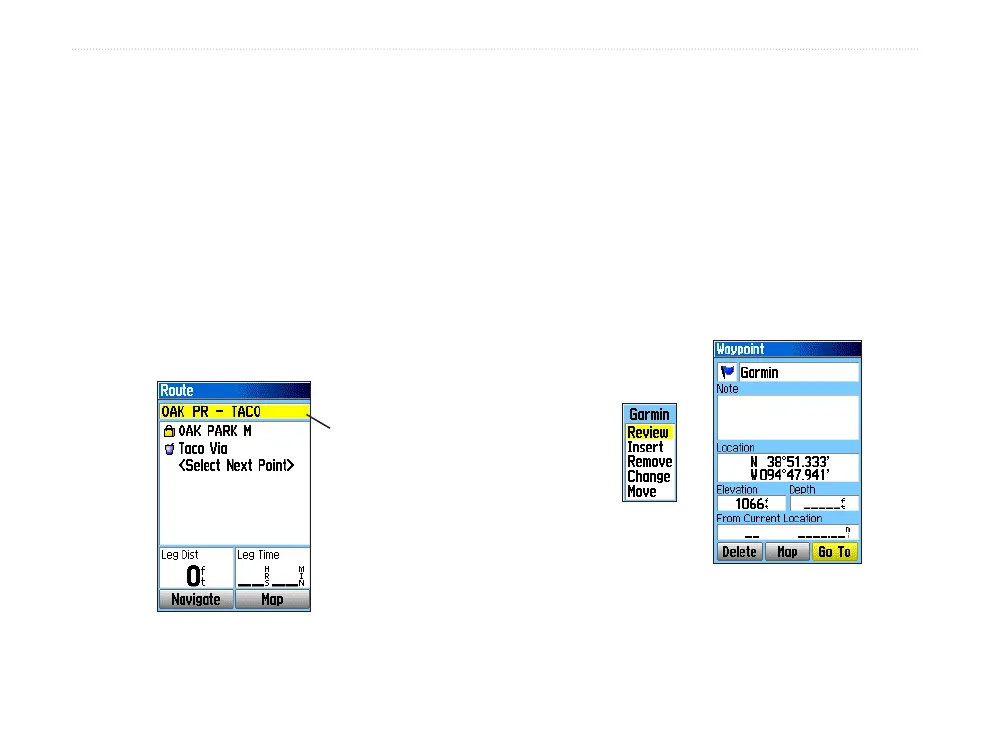
Modication d’un itinéraire
Aprèsavoircrééunitinéraire,utilisezlapageRoute
pourlemodier,lerenommerouconsultersespointsde
cheminement.
Pour renommer un itinéraire :
1. Appuyez deux fois sur MENU pour afcher le menu
principal.
2. Sélectionnez l’icône
Routes et appuyez
sur
ENTER.
3. Sélectionnez un itinéraire enregistré et appuyez
sur
ENTER.
4. Sélectionnez le champ du nom d’itinéraire gurant
en haut de la page Route et appuyez sur
ENTER.
Entrez un
nouveau
nom
d’itinéraire
Page Route
5. Utilisez la touche à bascule pour renommer
l’itinéraire avec le clavier virtuel.
Pour un aperçu des points d’un itinéraire :
1. Appuyez deux fois sur MENU pour afcher le menu
principal.
2. Sélectionnez l’icône
Routes et appuyez
sur
ENTER.
3. Sélectionnez un itinéraire enregistré et appuyez
sur
ENTER.
4. Sélectionnez un point dans la page Route et
appuyez sur
ENTER pour afcher un menu
d’options.
5. Sélectionnez l’option
Review et appuyez
sur
ENTER pour afcher la page d’information sur
le point.
Options de
consultation
des points de
cheminement
Page
d’information
6. Sélectionnez Save pour enregistrer le point comme
point de cheminement, Map pour l’afcher sur la
carte ou Go To pour naviguer vers ce point, puis
appuyez sur
ENTER.