Do you have a question about the GME G-Plot G142C and is the answer not in the manual?
Provides safety warnings and precautions for unit operation.
Guidelines for safely cleaning the unit's display.
Key points on installation, GPS, and language settings.
Overview of the chartplotter's features and capabilities.
Detailed technical specifications for the G142C model.
Detailed technical specifications for the G142CFD model.
Details of NMEA 0183 and NMEA 2000 data interfacing.
Technical parameters of the sonar and fishfinding functions.
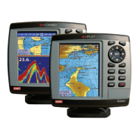
Lists all components supplied with the GME G•COMBO unit.
Instructions for bracket and flush mounting the chartplotter.
Step-by-step guide for installing the unit using a bracket.
Step-by-step guide for installing the unit using a flush mount kit.
Explains the purpose and function of each control button on the unit.
Instructions for inserting and removing C-MAP SD cards for navigation data.
How to use the simulation mode for learning unit functions.
Steps to set up and show navigation data in the data bar.
Steps to customize data fields and change data bar size.
How to enable, disable, and use the compass feature.
Using and configuring multiple on-screen windows for data display.
Saving and recalling preferred window layouts for quick access.
How to mark a MOB location and navigate back to it.
Procedures for manual and automatic power management of the unit.
How to change brightness, night mode, and background color.
How to access and select different function pages from the main menu.
Description of the main chart display elements and data shown.
How to use the 3D perspective chart view for enhanced navigation.
Understanding coordinate display and cursor position references.
How to zoom in and out to change the chart's level of detail.
How to search for ports, services, and other points of interest on the chart.
Viewing detailed information associated with chart symbols.
Basic methods for planning and executing navigation courses.
Procedures for initiating navigation to a selected destination point.
How to navigate a sequence of waypoints forming a route.
Direct navigation to a cursor-defined point using the GOTO key.
Tools for measuring distances and bearings between points.
Setting time for projected course display to aid collision avoidance.
Understanding the various elements shown on the sonar screen.
Choosing between automatic and manual sonar modes for optimal performance.
Using 50kHz and 200kHz frequencies for detailed fish and bottom detection.
Setting the depth range displayed on the sonar screen.
Adjusting signal strength parameters for better target identification.
Selecting different window configurations for sonar data display.
Using the sonar display without splitting the screen for a single frequency.
Using zoom capabilities for detailed sonar views.
Utilizing the split bottom view to focus on bottom detection.
Comparing dual frequency sonar data simultaneously.
Detailed view of echo strength and history for target analysis.
Methods for creating waypoints from chart or waypoint list.
Repositioning and modifying existing waypoint data.
Removing waypoints from the system's memory.
Searching for saved waypoints within the list.
Reordering the list of saved waypoints by different criteria.
Clearing the entire waypoint list from the unit.
Building routes by selecting points directly on the chart.
Editing and creating routes via the route list interface.
Modifying route waypoints directly on the chart display.
Removing waypoints from routes or deleting entire routes.
Visualizing saved routes on the main chart display.
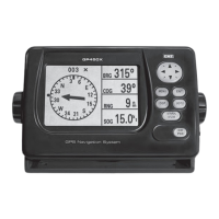
How to view GPS position and satellite reception data.
Methods to view tide information from chart or dedicated window.
Choosing the specific date for which tide data is displayed.
Displaying information about nearby AIS-equipped vessels on screen.
Options for displaying AIS data in different windows or tabs.
Accessing comprehensive data for individual AIS targets.
Procedures for receiving, displaying, and acting on DSC distress calls.
Modifying waypoints automatically created from distress calls.
Procedures for deleting individual or all DSC call logs.
Requesting and displaying positions of other vessels via DSC.
Showing polled vessel information directly on the chart display.
Setting navigation to a vessel's position obtained via DSC poll.
Initial setup for language, beep volume, auto power, and features.
Customizing display language, audible alerts, and automatic power functions.
Configuring connected devices, restoring defaults, and viewing unit information.
Setting chart orientation (North Up, Heading Up) and color schemes.
Configuring plotter mode, anti-clutter, mixing levels, and other chart features.
Controlling the display of various chart elements like VAD, grids, names, and nav-aids.
Enabling/disabling display of geographical features, depths, and tidal streams.
Selecting coordinate systems and adjusting NMEA datum offsets.
Applying positional shifts to align chart data accurately with the vessel's location.
Resetting all chart configurations to their factory defaults.
Choosing between 50kHz, 200kHz, or mixed frequencies for sonar operation.
Customizing display colors and the speed of the sonar scan.
Adjusting depth display size and configuring fish detection sensitivity.
Using interference, noise, and clutter filters for clearer sonar images.
Resetting all sonar configurations to their factory defaults.
Choosing primary and differential GPS signal inputs.
Adjusting settings for stationary boats and filtering navigation data.
Setting NMEA precision for coordinate output and inputting boat speed.
Adjusting for differences between true and magnetic north.
Managing track recording, colors, thickness, and plotting intervals.
Resetting trip and total distance logs for accurate tracking.
Procedures for saving data to and loading data from the user card.
Removing saved data and preparing the user card for reuse.
Capturing and saving current screen images for reference or documentation.
Controlling which AIS targets are displayed based on type, distance, or speed.
Setting up proximity, TCPA, and CPA alarms for dangerous vessels.
Customizing projected course display time and range ring visibility.
Resetting all AIS configurations to their factory defaults.
Configuring alarms for fish detection, depth limits, and shallow water conditions.
Setting alarms for temperature readings, battery voltage, and navigation events.
Configuring alarms for AIS threats, DGPS signal loss, and restoring defaults.
Configuring simulation mode and accessing GPS setup menu.
Selecting preferred units for various measurements like distance, speed, and depth.
Configuring NMEA data transmission, reception, and port settings.
Calibrating speed, temperature, offsets, and filters for accurate readings.
Setting time and date formats and accessing the calendar function.
Resetting miscellaneous system configurations to their factory defaults.
List of compatible external sensors and instruments for the chartplotter.
Diagram and description of all external connectors on the unit.
Step-by-step instructions for connecting power and data cables for basic and auto power.
How to connect external alarm beepers or lights to the unit.
Instructions for selecting and installing GPS antennas, including internal and external options.
Details on installing external antennas and connecting via NMEA.
Connecting and configuring devices like DSC VHF radio and AIS receivers via NMEA 0183.
Instructions for installing and configuring an optional DSC VHF radio.
Connecting and configuring other compatible NMEA instruments.
Connecting the chartplotter to NMEA 2000 compatible marine electronics.
Instructions for fitting and connecting sonar transducers for optimal performance.
Performing final checks and tests after installation, including GPS satellite acquisition.
Legal warranty information and conditions for the product.
Clauses outlining limitations of liability and warranty exclusions.
Details on after-sales service, support, and contact information for GME.