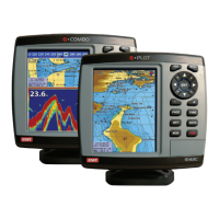
PAGE 4 INSTRUCTION MANUAL G-COMBO
1 Introduction
1-1 General Information .........................7
1-2 Specification ...............................7
1-3 Packing List ...............................9
1-4 Optional Accessories .......................10
2 Getting Started
2-1 Mounting the Unit .........................10
2-1-1 Bracket Mounting ........................10
2-1-2 Flush Mounting ..........................10
2-2 Keys ....................................11
2-3 C-MAP MAX Secure Digital (SD) Card ........... 11
2-4 Simulate Mode ............................11
2-5 Data Bar .................................11
2-6 Compass ................................12
2-7 Multi window displays ......................13
2-8 Man overboard (MOB) ......................13
3 General Operation
3-1 Manual / Auto Power on and off ...............14
3-2 Brightness, night mode and Background ........14
3-3 The page window .......................... 14
3-4 Chart ...................................16
3-4-1 Chart window ...........................16
3-4-2 Perspective view .........................16
3-4-3 Latitude and longitude ....................17
3-4-4 Chart scale .............................17
3-4-5 Finding a chart symbol ....................17
3-4-6 S-Map search ...........................18
3-4-7 Chart symbols and information ..............18
3-4-8 Introduction to navigating .................18
3-4-9 Following a route ........................19
3-4-10 Goto Key ..............................19
3-4-11 Distance and bearing calculator .............20
3-4-12 Projected course ........................20
3-5 Sonar ...................................20
3-5-1 Interpreting the display ....................20
3-5-2 Mode .................................20
3-5-3 Single and Dual frequency fish finding ........21
3-5-4 Range .................................21
3-5-5 Gain ..................................22
3-5-6 Sonar window display .....................22
3-5-7 No split ................................22
3-5-8 Split zoom and Full Screen zoom .............23
3-5-9 Split bottom ............................23
3-5-10 Split 50/200 ...........................23
3-5-11 Split A-Scope ...........................24
3-6 Highway ................................. 24
3-7 Gauges .................................. 24
3-8 Waypoints ...............................25
3-8-1 Creating a new waypoint ..................25
3-8-2 Moving a waypoint .......................25
3-8-3 Editing an existing waypoint ................25
3-8-4 Deleting a waypoint ......................25
3-8-5 Find a waypoint .........................25
3-8-6 Sort Waypoints ..........................26
3-8-7 Deleting all waypoints ..................... 26
3-9 Routes ..................................26
3-9-1 Managing a route from the chart window ......26
3-9-2 Managing a route from the route window ......27
3-10 Satellites ................................ 28
3-10-1 Satellite information .....................28
3-11 Tides ................................... 28
3-12 AIS ....................................29
3-12-1 Viewing AIS Vessels ......................29
3-12-2 AIS Windows ...........................29
3-13 DSC ...................................30
3-13-1 Distress ...............................30
3-13-2 Poll ..................................31
3-14 NAVTEX ................................32
CONTENTS