14
5
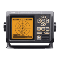
BASIC OPERATION
5
7
10
15
18
8
13
11
16
9
14
6
12
17
1
4
2
3
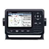
D Highway screen
Displays the highway information.
1 2
3
4
5
6
9
5
6 78
1OWN SHIP INDICATOR
Displayed in the center of the compass.
2WAYPOINT NAME
Displays the waypoint’s name.
L “AIS target” is displayed when
navigating to the AIS target.
L “MOB” is displayed while in the MOB
mode. (p. 27)
L “Navigation OFF” is displayed when the
Navigation mode is not used.
3COMPASS
Displays the direction based on your
COG (Course Over Ground).
4XTE
Displays the Cross Track Error.
5STEERING DIRECTION
Displayed when the vessel crosses the
XTE (Cross Track Error) limit line.
6XTE LIMIT LINE
Displays the limit line that marks when
the vessel goes o course.
7NAVIGATION LINE
Displays a line from the start position of
navigation to the AIS target or waypoint.
8YOUR VESSEL ICON
Displayed according to the destination's
position.
L When your vessel moves less than 2
knots,
is displayed.
9RNG
Displays the range (RNG) from your
vessel to the target.
D AIS and Highway screen
Displays the plotter display and highway
information.
1
2
1HIGHWAY
Displayed during navigation.
L “Navigation OFF” is displayed on the
Highway screen when the Navigation
mode is not used.
L See “Highway screen” for details.
2INFORMATION
Displays the following information.
• RNG (Range)
• XTE (Cross Track Error)
• SOG (Speed Over Ground)
• COG (Course Over Ground)
 Loading...