55
English
7. Mobile Mapping
This guide presents the Mobile Mapping function in its
simplest implementation, i.e. using the ProMark3’s internal
antenna and with no differential mode enabled.
With a ProMark3 RTK using an external antenna, Mobile
Mapping can also be run in RTK mode, thus offering the same
accuracy level as in surveying.
Once you know how to perform RTK surveys with
ProMark3 RTK (see RTK Setup on page 11), it’s easy to
understand how you can extend the use of RTK to Mobile
Mapping. However, the current position status (“Float”,
“Fixed”, etc.) can only be seen on the Position screen (see
page 70).
Preliminary Steps
It is assumed that you have already run all the instructions
detailed in Chapter 2. Preparing For First-Time Use on page 4.
1. Turn on the receiver by pressing the red button.
2. Double-tap the Mobile Mapping icon.
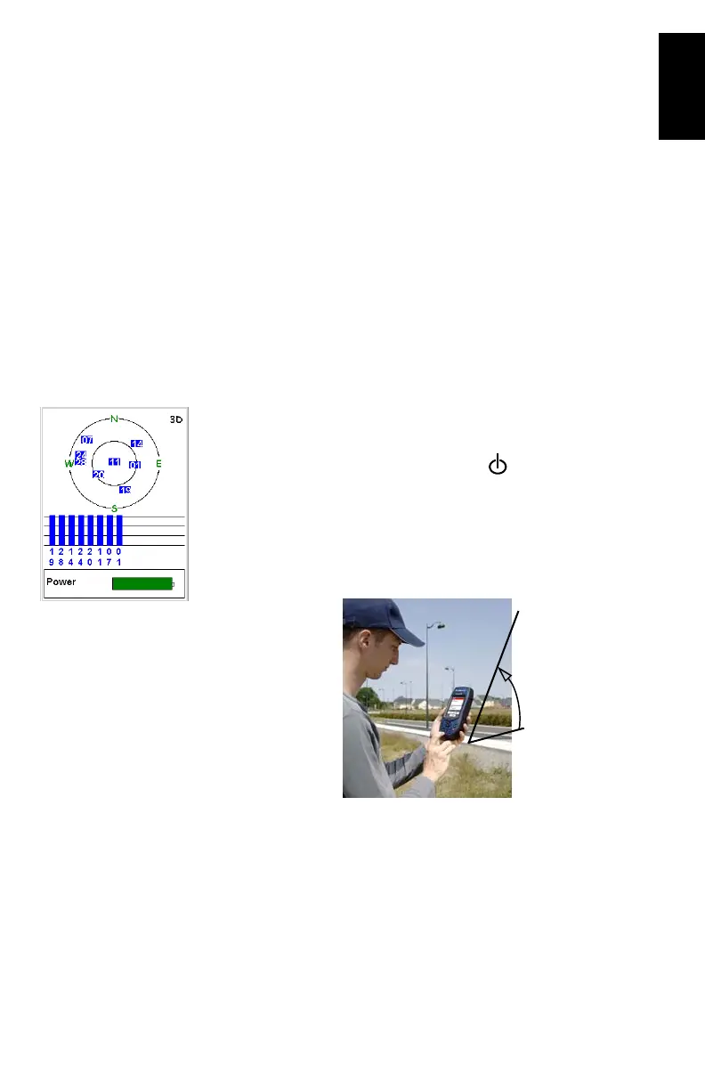
3. Press the NAV key until you see the Satellite Status screen
(see opposite) Wait until at least 4 satellites are received.
For the best accuracy it is important to hold the receiver at
an angle of 45° from horizontal and not too close to you.
Satellite Status screen
45°