OVERVIEW: Global Positioning System (GPS) Section
1.10 Global Positioning System (GPS) Section
The U.S. Department of Defense (DoD) operates a constellation of 24-satellites, employed
for location and/or navigational purposes, on earth. These satellite vehicles (SV) operate
in circular orbits, round the earth every 12 hours, at an altitude of 20,200 km. The SVs
transmit earth-bound radio signals at a 1575.42 MHz fixed carrier frequency—an L1 band
for non-military applications. Since the SVs utilize one carrier frequency, by employing a
Spread Spectrum modulation technique, each SV can be uniquely identified from an
assigned Pseudo-random Noise (PN) Code.
To determine a location on earth, a receiver must be built that can receive the
simultaneous signals from the satellites that are in view of the receiver and use that
information to calculate the location of the receiver. The receiver must pick up the signals
from 4 satellites. Once the 4 satellites are located, the receiver measures the time it took for
the satellite signals to arrive. From this timing information, the distance between the
receiver and each satellite can be calculated. The four satellites’ ephemeris data provide
the satellite’s X, Y, and Z positions. The range, R, is the receiver measurement made by
calculating the time it took for the signal to reach the receiver. The user’s position, (Ux, Uy,
Uz), and the clock bias, Cb, is then calculated.
To use the GPS, a receiver that can receive the spread-spectrum signals must be built. The
detected signals are then converted from RF signals into appropriate digital input
formats. These digital inputs are processed and converted into position information.
1.10.1 GPS Receiver
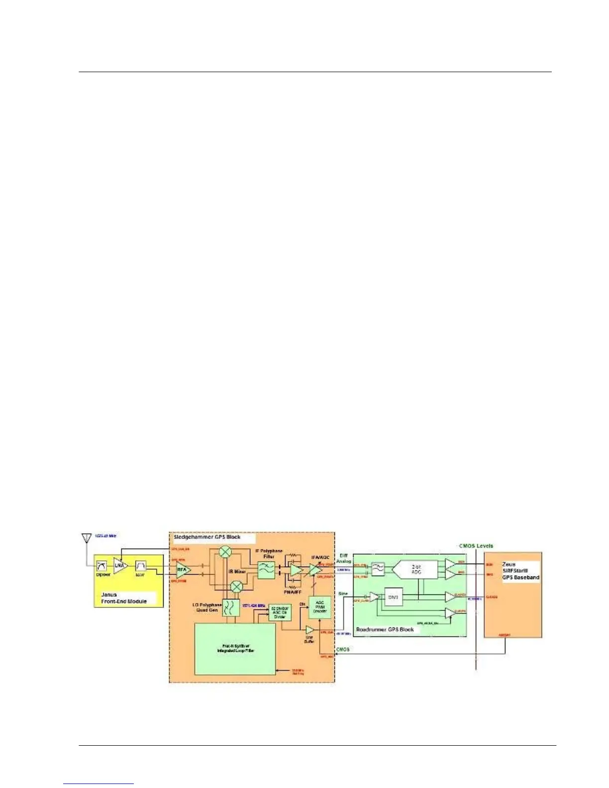
A block diagram of the receiver for the i897 is shown in Figure 1-19. The GPS receiver is based on
the SiRF SiRFStarIII GPS chipset.

 Loading...