9
Guidance Screen
Once a pattern is selected for the job, the Guidance Screen is displayed on
the Cruizer touch screen.
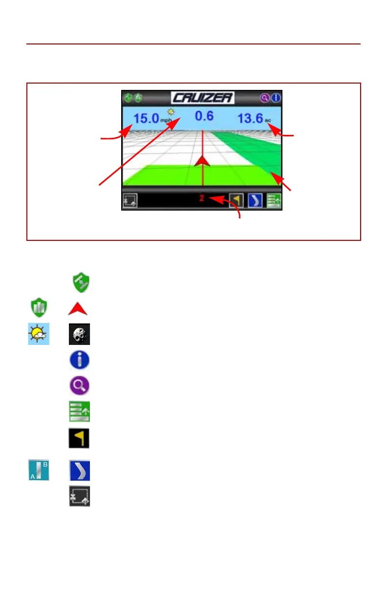
The Guidance Screen displays the following information:
The following icons are available from the Guidance Screen to access
different features or tools during an active job.
GPS Status
- Touch the GPS status icon to view the GPS
Status screen.
History - Touch either of these icons to start or stop
recording coverage history.
Day or Night - Touch the day or night icon to switch
between Day or Night display mode.
Information - Touch to view a brief explanation of the icons
displayed or accessible on the Guidance Screen.
Zoom- Zooms in each time it is pressed until maximum
zoom is reached then zooms out.
Menu - Touch to access other guidance views, available
path tools, or return to the Cruizer Home Screen.
Field Markers - Touch the icon to place a field marker at the
current vehicle location. Refer to the Field Markers section
on page 13 for more information.
Alternate Guidance - Touch the alternate guidance pattern
icon to toggle to the displayed pattern.
Boundary Mapping Menu- Select this icon to access
available boundary mapping tools.
Touch the Speed or
CoG (Course over
Ground) area to
toggle the information
displayed between
these two options.
Area Covered
tally displays the
total field area
covered by active
boom sections
(painted area on
the Cruizer
display).
Set A or B icons, Swath Number, or Last
Pass mode is displayed in this area.
Coverage
History
Distance to Path
Display shows the
distance and direction
from the vehicle to the
displayed guidance
path.

 Loading...
