Chapter 2: Getting Started 2-9
The chart scale in use is indicated in the status bar; the number represents the
distance (in nautical miles) displayed from the top to the bottom of the screen.
To obtain Navionics Nav-Chart cards contact your local dealer or:
Navionics S.p.A.
Via Vespucci 289
55049Viareggio
, Italy
Tel: (+39) 584 961696
Fax: (+39) 584 961309
website: www.navionics.com
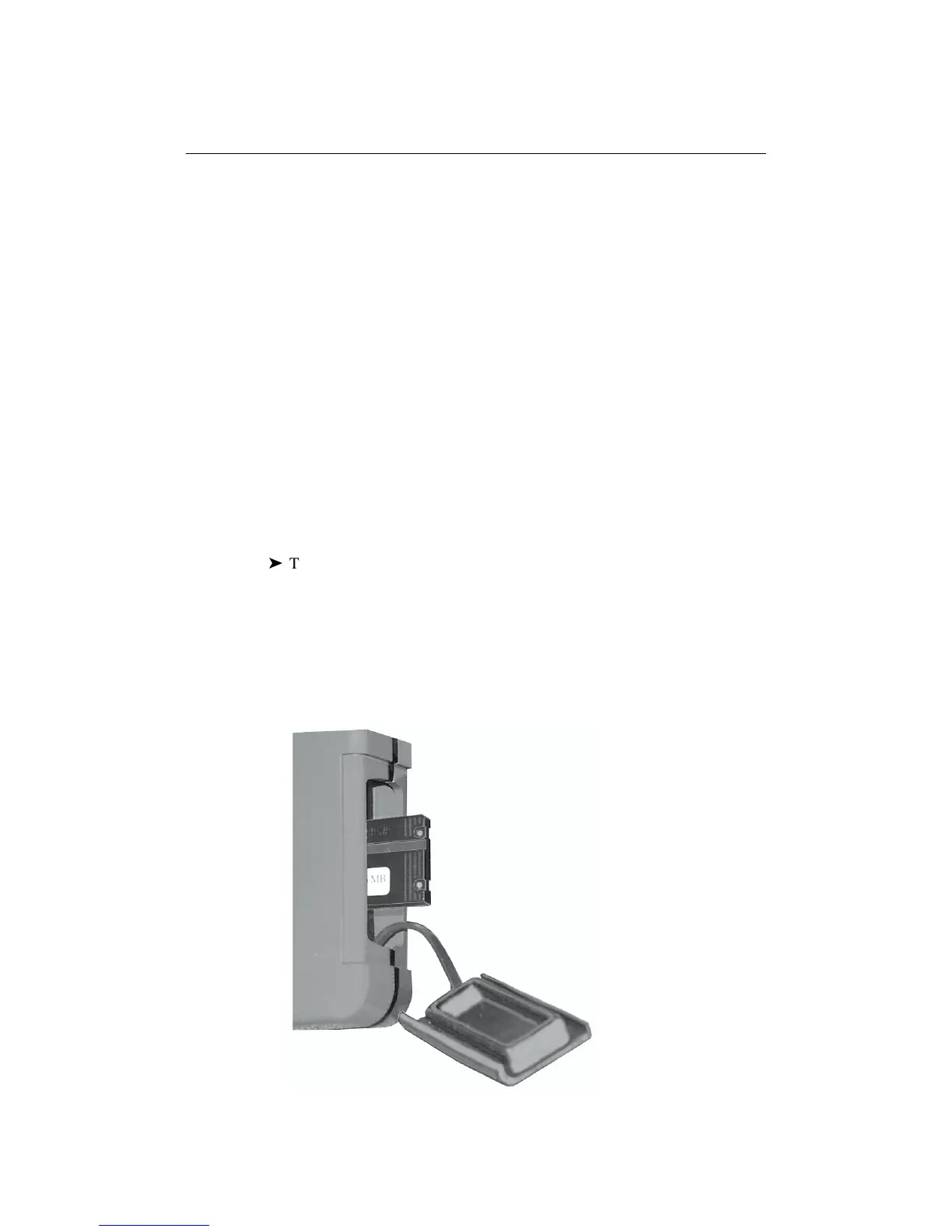
Inserting a Nav-Chart card
CAUTION
To prevent the ingress of water and consequent damage to the unit, always
ensure that the cartridge cover is fully and properly inserted, whether or
not a Nav-Chart card is inserted.
ä
To insert a Nav-Chart card:
1. Check that you are using the correct Nav-Chart card for the required area.
2. Pull out the cartridge cover at the right hand side of the unit.
3. Hold the card with the title label and keyway slot towards you, and the two
circular holes outermost, as shown below. Gently push the card into its slot
until it clicks into position. It will only fit in the correct orientation.
4. To prevent the ingress of water, replace the cartridge cover.
D4706_1