EasyManuals Logo

TomTom GO Basic User Manual

TomTom GO Basic
105 pages
To Next Page IconTo Next Page
To Previous Page IconTo Previous Page
Page #14 background imageLoading...
Page #14 background image
14
2. Route bar. The route bar is shown when you have planned a route.
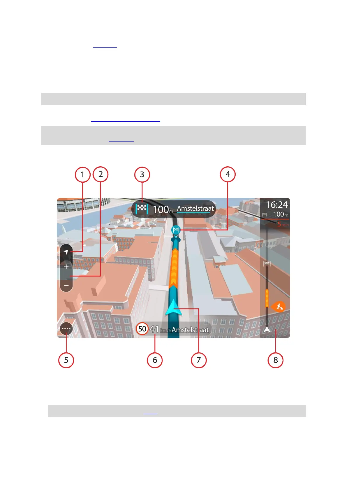
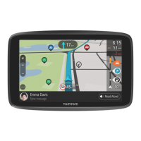
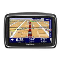
The guidance view
The guidance view is used to guide you along the route to your destination. The guidance view is
shown when you start driving. You see your current location and details along your route, including
3D buildings in some cities.
Note: 3D buildings in guidance view are not available on all devices.
The guidance view is normally in 3D. To show a 2D map with the map moving in your direction of
travel, change the 2D and 3D default settings.
Tip: When you have planned a route and the 3D guidance view is shown, select the switch view
button to change to the map view and use the interactive features.
When your TomTom GO starts after sleeping and you have a route planned, you are shown the
guidance view with your current location.
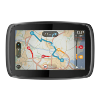
1. Switch view button. Select the switch view button to change between the map view and the
guidance view. When in guidance view, if you are driving, the small arrow rotates to indicate
your direction of travel relative to north, with north being up.
2. Zoom buttons. Select the zoom buttons to zoom in and out.
Tip: On some devices you can also pinch to zoom in and out.
3. Instruction panel. This panel shows the following information:
The direction of your next turn.
The distance to your next turn.

Table of Contents

Other manuals for TomTom GO Basic

Questions and Answers:

Question and Answer IconNeed help?

Do you have a question about the TomTom GO Basic and is the answer not in the manual?

TomTom GO Basic Specifications

General IconGeneral
Display diagonal5 \
Display resolution480 x 272 pixels
Spoken languages- Afrikaans - Arabic - Australian English - Bulgarian - Catalan - Croatian - Czech - Danish - Dutch - Dutch Belgium - Finnish - French - German - Greek - Hungarian - Irish English - Italian - Lithuanian - New Zealand English - Norwegian - Polish - Portuguese - Portuguese Brazil - Serbian - Slovenian - Spanish - Spanish (Latin American) - Spanish Argentina/Latin - Spanish Chile - Swedish - Turkish - UK English - US English
Languages supportBUL, CZE, DAN, DEU, DUT, ENG, ESP, EST, FIN, FRE, GRE, HUN, ITA, LAT, NOR, POL, POR, SWE, TUR
Spoken street namesKeep your eyes on the road while your GPS announces turn-by-turn directions, including street and place names.
Traffic Message Channel (TMC)-
Cables includedUSB
Marine (chartplotters, sounders)No
Map coverageAll Europe
Lifetime map updatesRoads change, but with Lifetime Map Updates your map will always be up to date. Start fresh every few months by downloading a new edition of the industry's most accurate map. New editions are issued four times per year.
Number of countries covered45
Storage media typeFlash
Compatible memory cardsMicroSD (TransFlash)
Maximum memory card size32 GB
Internal storage capacity16 GB
Form factorFixed
Product colorBlack
Power source typeBattery, Cigar lighter
Battery life (max)1 h
Weight and Dimensions IconWeight and Dimensions
Depth18.85 mm
Width141.96 mm
Height90.6 mm
Weight201 g

Related product manuals