EasyManua.ls Logo

TomTom GO Basic User Manual

TomTom GO Basic
105 pages
To Next Page IconTo Next Page
To Previous Page IconTo Previous Page
Page #16 background image
16
TomTom Speed Cameras and Danger Zones.
Rest stops directly on your route.
You can choose the information you see on your route.
The symbols are in the order that they occur on your route. For traffic
incidents, the symbol for each incident alternates between showing the
type of incident and the delay in minutes. Select a symbol to see more
information about a stop, an incident or a speed camera. If a symbol is
shown on top of another symbol, selecting the symbols zooms in on the
route bar to show each symbol separately. You can then select a symbol.
The total time delay due to traffic jams and other incidents on your
route, including information provided by IQ Routes, is shown above the
symbols.
For a complete list of incident types, see Traffic incidents.
The bottom of the route bar represents your current location and shows
the distance to the next incident on your route.
Note: To make the route bar more readable some incidents may not be shown. These incidents
will always be of minor importance and only cause short delays.
The route bar also shows status messages, for example Finding fastest route or Playing route
preview.
Distances and the route bar
The distance ahead shown on the route bar depends on the length of your route, or the distance
remaining on your route.
For remaining distances longer than 50 km (31 miles), only the next 50 km (31 miles) is shown.
The destination icon is not shown.
Tip: You can scroll the route bar to see your whole route (not available on iOS).
For remaining distances between 10 km (6 miles) and 50 km (31 miles), the complete distance is
shown. The destination icon is shown fixed at the top of the route bar.
For remaining distances of less than 10 km (6 miles) the complete distance is shown. The
destination icon moves down towards the chevron symbol as you get nearer to your destination.
The top half of the route bar shows twice the distance of the bottom half, as shown in the following
examples:
A remaining distance of 50 km on the route bar is split into 34 km (21 miles) at the top and 16
km (9 miles) at the bottom.
A remaining distance of 10 km on the route bar is split into 6.6 km (4 miles) at the top and 3.3
km (2 miles) at the bottom.
The route bar is constantly updated as you drive.
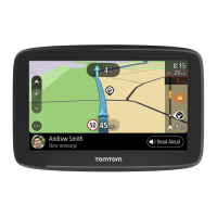
The quick menu
To open the quick menu, select the current location symbol or the speed panel in the guidance
view.
You can then do any of the following:
Mark a location
Change a speed limit
Avoid a blocked road
See your current location or your latitude/longitude if not on a named road.

Table of Contents

Other manuals for TomTom GO Basic

Question and Answer IconNeed help?

Do you have a question about the TomTom GO Basic and is the answer not in the manual?

TomTom GO Basic Specifications

General IconGeneral
Display diagonal5 \
Display resolution480 x 272 pixels
Spoken languages- Afrikaans - Arabic - Australian English - Bulgarian - Catalan - Croatian - Czech - Danish - Dutch - Dutch Belgium - Finnish - French - German - Greek - Hungarian - Irish English - Italian - Lithuanian - New Zealand English - Norwegian - Polish - Portuguese - Portuguese Brazil - Serbian - Slovenian - Spanish - Spanish (Latin American) - Spanish Argentina/Latin - Spanish Chile - Swedish - Turkish - UK English - US English
Languages supportBUL, CZE, DAN, DEU, DUT, ENG, ESP, EST, FIN, FRE, GRE, HUN, ITA, LAT, NOR, POL, POR, SWE, TUR
Spoken street namesKeep your eyes on the road while your GPS announces turn-by-turn directions, including street and place names.
Traffic Message Channel (TMC)-
Cables includedUSB
Marine (chartplotters, sounders)No
Map coverageAll Europe
Lifetime map updatesRoads change, but with Lifetime Map Updates your map will always be up to date. Start fresh every few months by downloading a new edition of the industry's most accurate map. New editions are issued four times per year.
Number of countries covered45
Storage media typeFlash
Compatible memory cardsMicroSD (TransFlash)
Maximum memory card size32 GB
Internal storage capacity16 GB
Form factorFixed
Product colorBlack
Power source typeBattery, Cigar lighter
Battery life (max)1 h
Weight and Dimensions IconWeight and Dimensions
Depth18.85 mm
Width141.96 mm
Height90.6 mm
Weight201 g

Summary

Welcome to Navigation with TomTom

Get Going

Instructions for installing and starting up the TomTom GO Basic device.

Planning a Route

Guide on how to plan routes using various methods like addresses or POIs.

Get Going

Installing in Your Car

Step-by-step instructions for mounting the device in a vehicle.

Positioning the Device

Guidance on optimal placement of the device in the car for safety and visibility.

Get Going: Device Setup and Operation

Setting Up Your Device

Initial configuration steps when first switching on the device.

Get Going: Troubleshooting and Care

Device Not Starting

Troubleshooting steps if the device fails to start or respond.

Charging Your Device

Instructions on how to charge the device's battery.

What's on the Screen

The Guidance View

Details of the screen display during active route guidance.

Screen Interface Details

The Route Bar

Explanation of the route bar, including arrival information and route symbols.

Navigation Buttons and Menu Access

Drive To Functionality

Accessing the menu to search for destinations by address, POI, or coordinates.

Syncing with TomTom MyDrive

About TomTom MyDrive

Overview of MyDrive for managing POI files and syncing data.

Logging into Your TomTom Account

Steps to log in to your TomTom account to enable syncing.

Finding and Syncing Locations

How to find and sync locations between MyDrive and your TomTom GO.

MyDrive Data Management

Importing Track GPX Files

Instructions for importing track files (.GPX) for navigation.

MyDrive: Saving and Restoring Data

Using Step-by-Step Search

About Search Functionality

Overview of the search functionality for addresses and POIs.

Entering Search Terms

How to input search queries using the on-screen keyboard.

Planning a Route Using Step-by-Step Search

Planning a Route to an Address

Step-by-step guide to planning a route to a specific street address.

Planning a Route to a POI

How to find and plan a route to a Point of Interest (POI).

Planning a Route to a City Centre

Method for planning a route to a city's central area.

POI Search Options

Planning a Route to a POI Using Online Search

How to perform an online search for Points of Interest.

Route Planning via Map Interaction

Planning a Route Using the Map

How to plan a route by directly interacting with the map interface.

Planning a Route Using My Places

Accessing My Places

Using the My Places feature to access saved favorite locations.

Planning a Route Using Coordinates

Planning a Route in Advance

Locating Points of Interest

Changing Your Route

The Current Route Menu

Options available for modifying the active route.

Adding a Stop to Your Route

Inserting intermediate waypoints into an existing route.

Route Modification Options

Avoiding Blocked Roads

Rerouting the current route to bypass road blockages.

Avoiding Part of a Route

How to exclude specific segments of the current route.

My Routes Management

About My Routes

Overview of saving and managing routes and tracks.

Saving a Route

Steps to store a planned route in the My Routes list.

Navigating Using a Saved Route

How to initiate navigation using a previously stored route.

Navigating Saved Routes

Navigating to a Stop on a Saved Route

Starting navigation from a specific waypoint within a saved route.

Adding Stops to Saved Routes

Recording and Navigating Tracks

Navigating Using an Imported Track

How to follow an imported track file for navigation.

Track and Route Management

Importing Routes and Tracks from Memory Card

Map Share: Reporting Map Changes

About Map Share

Overview of reporting and sharing map changes with other users.

Creating a Map Change Report

How to report map inconsistencies directly on the map interface.

Types of Map Change

Traffic Information

The Route Bar and Traffic

How traffic information is displayed within the route bar.

Traffic Incident Details and Warnings

Approaching Traffic Jam Warnings

How the device alerts users about upcoming traffic jams.

Avoiding Traffic Jams

Speed Cameras

About Speed Cameras

Overview of the speed camera warning system and types of cameras.

Updating Speed Camera and Hazard Locations

Danger Zones

My Places: Managing Favorite Locations

Setting Home or Work Location

Defining and managing home and work addresses for quick navigation.

Adding Locations to My Places

Settings: Customizing Your Device

View and Voice Settings

Map and Route Planning Settings

Route Planning Settings

Setting preferences for route calculation and suggestions.

Sound and Warning Settings

Updating with MyDrive Connect

Related product manuals