EasyManuals Logo

TomTom GO Basic User Manual

TomTom GO Basic
105 pages
To Next Page IconTo Next Page
To Previous Page IconTo Previous Page
Page #67 background imageLoading...
Page #67 background image
67
The symbols are in the order that they occur on your route. For traffic
incidents, the symbol for each incident alternates between showing the
type of incident and the delay in minutes. Select a symbol to see more
information about a stop, an incident or a speed camera. If a symbol is
shown on top of another symbol, selecting the symbols zooms in on the
route bar to show each symbol separately. You can then select a symbol.
The total time delay due to traffic jams, weather, and other incidents on
your route, including information provided from historical road usage, is
shown above the symbols.
For a complete list of incident types, see Traffic incidents.
The bottom of the route bar represents your current location and shows
the distance to the next incident on your route. In addition, you can
choose to see the current time if you switch the setting on.
Note: To make the route bar more readable some incidents may not be shown. These incidents
will always be of minor importance and only cause short delays.
The route bar also shows status messages, for example Finding fastest route or Playing route
preview.
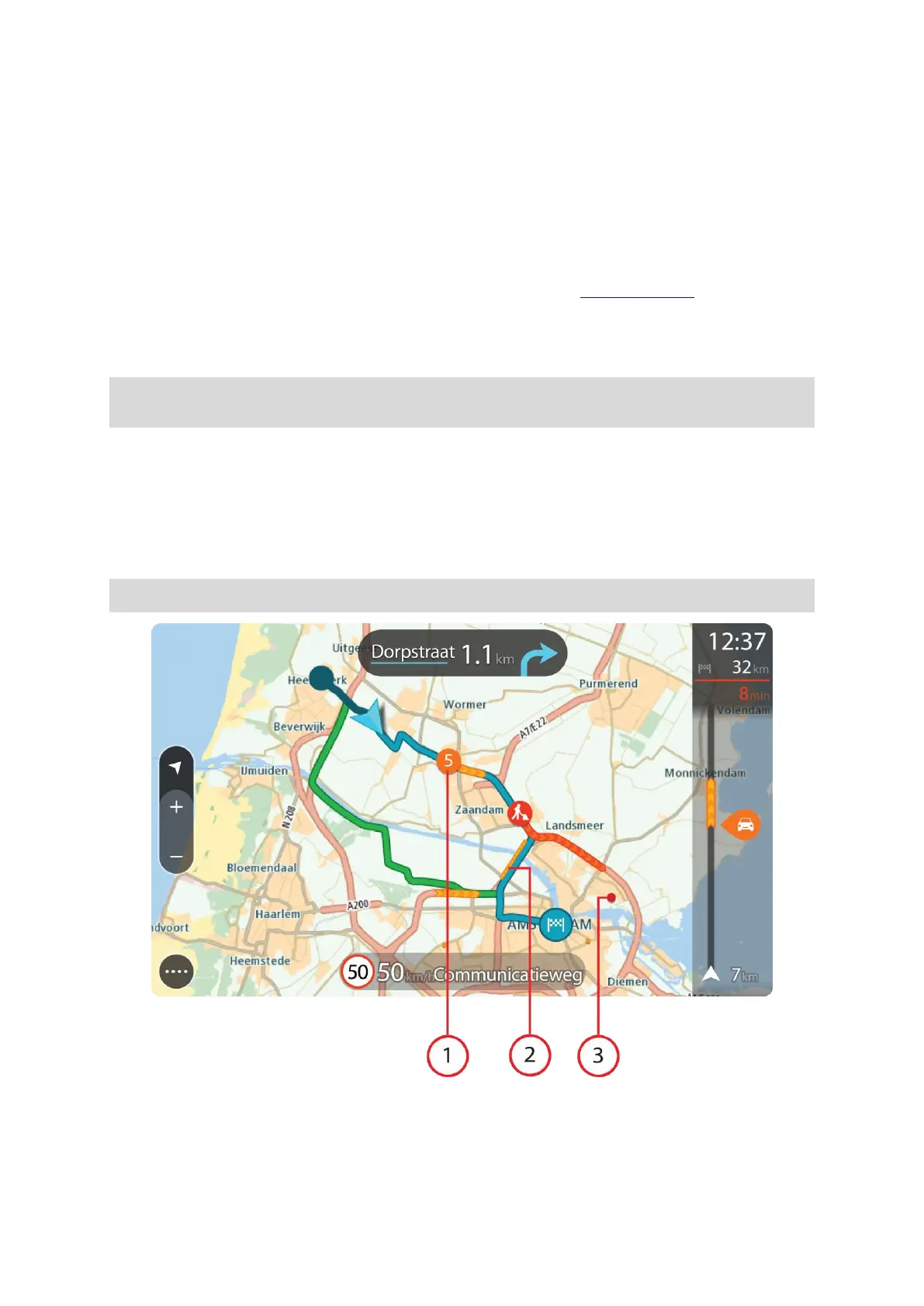
Looking at traffic on the map
Traffic incidents are shown on the map. If several traffic incidents overlap the highest priority
incident is shown - for example, a road closure is higher priority than road works or a closed lane.
Tip: Select an incident on the map to see more detailed information.
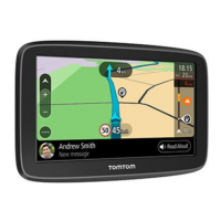
1. Traffic incident that affects your route in your direction of travel.
A symbol or number at the start of the incident shows the type of incident or the delay in
minutes, for example 5 minutes.

Table of Contents

Other manuals for TomTom GO Basic

Questions and Answers:

Question and Answer IconNeed help?

Do you have a question about the TomTom GO Basic and is the answer not in the manual?

TomTom GO Basic Specifications

General IconGeneral
Display diagonal5 \
Display resolution480 x 272 pixels
Spoken languages- Afrikaans - Arabic - Australian English - Bulgarian - Catalan - Croatian - Czech - Danish - Dutch - Dutch Belgium - Finnish - French - German - Greek - Hungarian - Irish English - Italian - Lithuanian - New Zealand English - Norwegian - Polish - Portuguese - Portuguese Brazil - Serbian - Slovenian - Spanish - Spanish (Latin American) - Spanish Argentina/Latin - Spanish Chile - Swedish - Turkish - UK English - US English
Languages supportBUL, CZE, DAN, DEU, DUT, ENG, ESP, EST, FIN, FRE, GRE, HUN, ITA, LAT, NOR, POL, POR, SWE, TUR
Spoken street namesKeep your eyes on the road while your GPS announces turn-by-turn directions, including street and place names.
Traffic Message Channel (TMC)-
Cables includedUSB
Marine (chartplotters, sounders)No
Map coverageAll Europe
Lifetime map updatesRoads change, but with Lifetime Map Updates your map will always be up to date. Start fresh every few months by downloading a new edition of the industry's most accurate map. New editions are issued four times per year.
Number of countries covered45
Storage media typeFlash
Compatible memory cardsMicroSD (TransFlash)
Maximum memory card size32 GB
Internal storage capacity16 GB
Form factorFixed
Product colorBlack
Power source typeBattery, Cigar lighter
Battery life (max)1 h
Weight and Dimensions IconWeight and Dimensions
Depth18.85 mm
Width141.96 mm
Height90.6 mm
Weight201 g

Related product manuals