EasyManuals Logo

TomTom GO Basic User Manual

TomTom GO Basic
105 pages
To Next Page IconTo Next Page
To Previous Page IconTo Previous Page
Page #39 background imageLoading...
Page #39 background image
39
1. Move the map and zoom in until you can see the destination that you want to navigate to.
Tip: You can also select a map symbol to open the pop-up menu, then select the Drive/Ride
button to plan a route to that location.
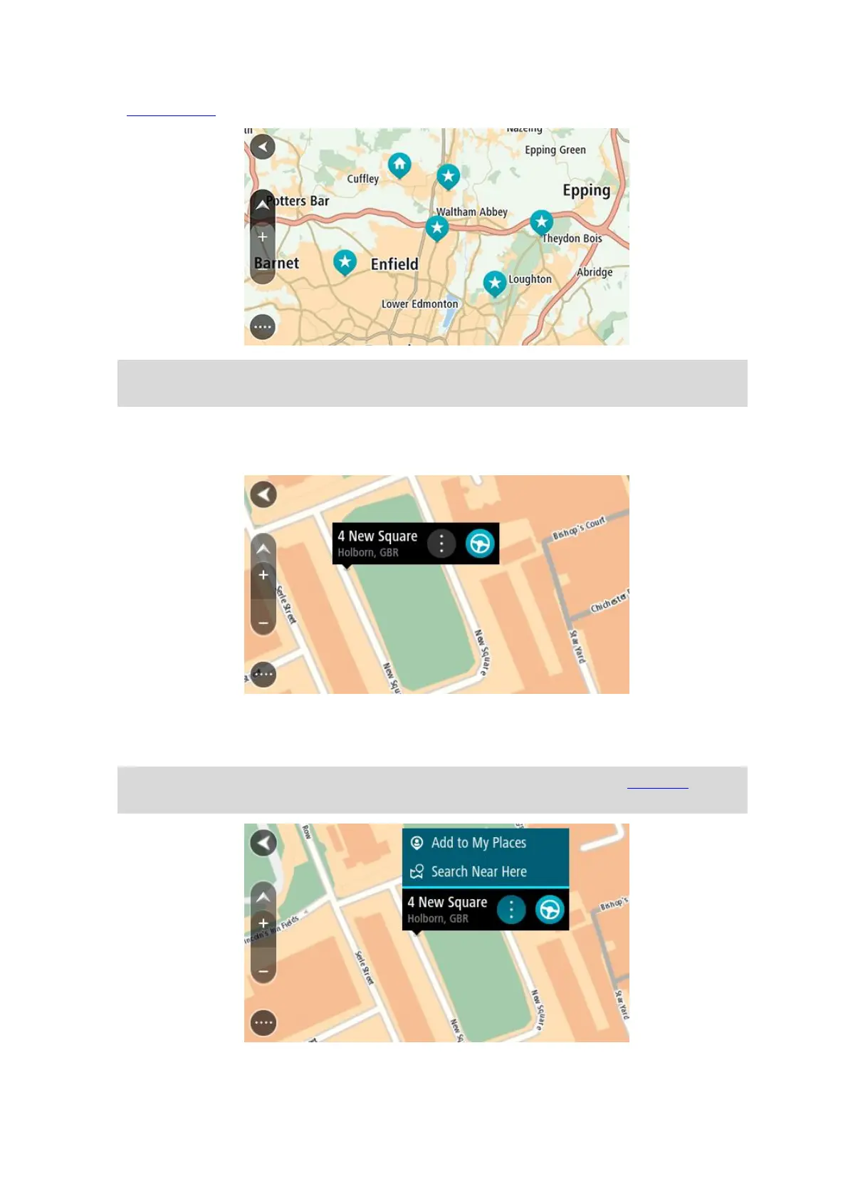
2. When you have found your destination on the map, select it by pressing and holding the screen
for about one second.
A pop-up menu shows the nearest address.
3. To plan a route to this destination, select Drive/Ride depending on which device you are using.
A route is planned and then guidance to your destination begins. As soon as you start driving,
the guidance view is shown automatically.
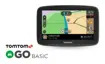
Tip: You can use the location you selected in other ways, such as adding it to My Places, by
selecting the pop-up menu button.

Table of Contents

Other manuals for TomTom GO Basic

Questions and Answers:

Question and Answer IconNeed help?

Do you have a question about the TomTom GO Basic and is the answer not in the manual?

TomTom GO Basic Specifications

General IconGeneral
Display diagonal5 \
Display resolution480 x 272 pixels
Spoken languages- Afrikaans - Arabic - Australian English - Bulgarian - Catalan - Croatian - Czech - Danish - Dutch - Dutch Belgium - Finnish - French - German - Greek - Hungarian - Irish English - Italian - Lithuanian - New Zealand English - Norwegian - Polish - Portuguese - Portuguese Brazil - Serbian - Slovenian - Spanish - Spanish (Latin American) - Spanish Argentina/Latin - Spanish Chile - Swedish - Turkish - UK English - US English
Languages supportBUL, CZE, DAN, DEU, DUT, ENG, ESP, EST, FIN, FRE, GRE, HUN, ITA, LAT, NOR, POL, POR, SWE, TUR
Spoken street namesKeep your eyes on the road while your GPS announces turn-by-turn directions, including street and place names.
Traffic Message Channel (TMC)-
Cables includedUSB
Marine (chartplotters, sounders)No
Map coverageAll Europe
Lifetime map updatesRoads change, but with Lifetime Map Updates your map will always be up to date. Start fresh every few months by downloading a new edition of the industry's most accurate map. New editions are issued four times per year.
Number of countries covered45
Storage media typeFlash
Compatible memory cardsMicroSD (TransFlash)
Maximum memory card size32 GB
Internal storage capacity16 GB
Form factorFixed
Product colorBlack
Power source typeBattery, Cigar lighter
Battery life (max)1 h
Weight and Dimensions IconWeight and Dimensions
Depth18.85 mm
Width141.96 mm
Height90.6 mm
Weight201 g

Related product manuals