2023 Unitree Robotics. All rights reserved.
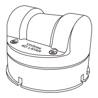
Unitree4D LiDAR-L1 User Manual
Unilidar is an operating software that can display and parse 3D point clouds in real-time, and sup-
ports advanced functions such as product settings and external parameter adjustments. By using
Unilidar software, users can perform simple graphical debugging. Before using Unilidar, it is neces-
sary to install the driver, which can be downloaded from www.unitree.com to view point cloud
images. Unilidar currently supports Windows® (64-bit).
For Windows users: unzip the file, open the unzipped folder, double-click on the program named
"CP210xVCPInstaller_x64" to install the driver, and run the Unilidar.exe program as an administrator.
For more detailed instructions on how to use Unilidar, please visit the official website at www.uni-
tree.com and download the "Unilidar User Manual" for more information.
The L1's LED light ring has eight modes to choose from, including command mode, slow forward
rotation, fast forward rotation, slow reverse rotation, fast reverse rotation, three-segment flip,
three-segment breathing, and six-segment breathing. Users can set different LED modes through
Unilidar or Unilidar SDK.
The default LED mode is six-segment breathing, and when using Unilidar point cloud software, it will
automatically switch to command mode. After the L1 is powered off and on again, it will maintain
the last used LED mode.
When using command mode, users can customize the state of each LED light bead. For detailed
configuration methods, please refer to the relevant chapters of the "Unilidar User Manual" and Unil-
idar SDK documentation.
Unilidar
LED Modes
In addition to using Unilidar to view real-time point cloud data, users can also use the Unilidar SDK
software development kit to apply the point cloud data obtained through the laser ranging instru-
ment to their own custom scenarios. This can achieve the following functions:
· Configure the laser ranging instrument: configure and query the laser ranging instrument parame-
ters and status information;
· Obtain point cloud data: point cloud coordinate data generated by the laser ranging instrument.
Visit https://www.unitree.com/en/download for more detailed information about the Unilidar SDK
documentation.
Unilidar SDK
11