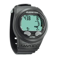
Altitude section 1
Desaturation time
Adaptation time
Altitude sections
1 2 3 4
6.2 Prohibited altitude
To avoid microbubbles, the Smart shows at surface
with flashing altitude segments, to which altitude
the diver may not rise. This attention message is
subject of the set MB-level.
The ascent prohibition can also be displayed together with an
altitude section:
You stay at 1200 metre (3937 ft) (altitude section
1) and you may ascend to range 2 only (2650 m /
8694 feet). You may not rise to the altitude section
3 or 4.
Ascent to altitude range 3
and 4 prohibited.
Max. allowed altitude:
2650 m (8694 ft).
Max. altitude: 850 m 1650 m 2650 m 4000 m
2790 ft 5413 ft 8694 ft 13120 ft
6.3 Decompression dives in mountain lakes
In order to assure optimal decompression even at higher altitudes, the 3m (10
ft) decompression stage is divided into a 4 m (13 ft) stage and a 2 m (7 ft)
stage. The prescribed decompression depths are, in sequence, 2m / 4m / 6m /
9m… (7 ft / 13 ft / 20 ft / 30 ft…).
If atmospheric pressure is below 620 mbar (8.99 psi) (altitude higher than
4100 m / 13450 ft above sea level), no decompression data is displayed (Depth
Gauge Mode).
This has the consequence, that the RBT (COM) and the dive planner are not avai-
lable anymore. The oxygen toxicity and the tank pressure (COM) are still indica-
ted.
COM
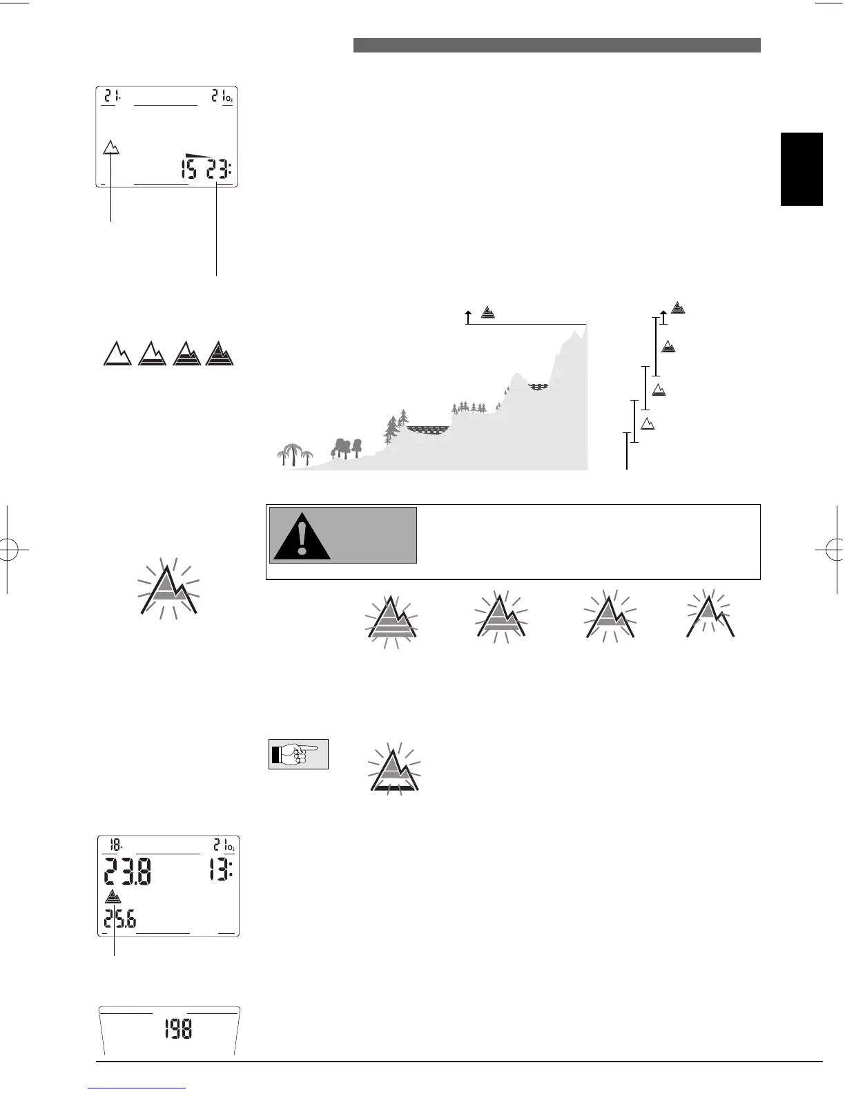
6.1 Altitude sections Smart measures every 60 seconds the atmospheric pressure even while the dis-
play is switched off. If the computer detects an increase in altitude, it switches
on automatically and indicates the new altitude section (1-4) and the desatu-
ration time. Desaturation time indicated at this moment refers to adaptation
time at this altitude. If the dive starts within this adaptation time, Smart treats
it as a repetitive dive, since the body still has a higher saturation.
The entire altitude range is divided into four sections, which are influenced by
barometric pressure. That is why the defined altitude sections overlap on their
fringes. If a mountain lake altitude is reached, the altitude section is indicated
at the surface, in the logbook and in the dive planner by a stylised mountain
filled with 4 segments representing the 4 sections. Sea level to an altitude of
approximately 1000m (3000 feet) is not indicated. In the following diagram,
you can see the approximate altitude ranges of the four sections: