Do you have a question about the CHCNAV i73 Plus and is the answer not in the manual?
Legal notice regarding ownership and trademarks of CHCNAV and its products.
Important precautions to prevent personal injury and equipment damage during operation.
Compliance statement for FCC radio frequency emission limits for Class B digital devices.
Guidelines and warnings for safe operation of the GNSS receiver, including warnings and cautions.
Information on wireless modem regulations and safe usage practices based on country requirements.
How to get assistance for product issues and inquiries via local dealer or CHCNAV support.
Legal notice regarding user responsibility, guide accuracy, and CHCNAV's right to update content.
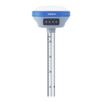
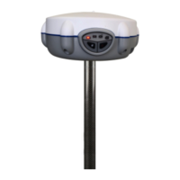
Overview of the i73+ GNSS receiver, its IMU-RTK technology, and capabilities.
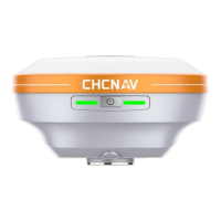
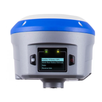
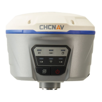
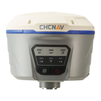
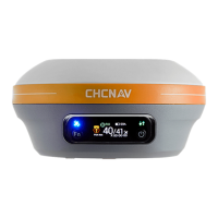
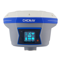
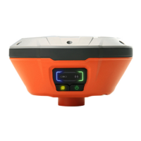
Identification of the receiver's front panel controls, indicator LEDs, and ports.
Details on internal batteries, charging procedures, safety precautions, and external power options.
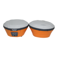
Listing of standard accessories included in the Rover Kit and Base Kit.
Instructions for connecting the receiver to a computer for data transfer or settings.
Steps for establishing Wi-Fi and Bluetooth connections to a controller using LandStar 7.
Procedures for downloading logged GNSS data via FTP, Web Server, or USB connection.
Guidelines for setting up the receiver as a base station for accurate post-processing.
Recommended setup procedures for using the receiver as a real-time rover.
Operation steps and important notes for activating and using the tilt compensation feature.
Reviewing receiver position, satellite status, clock information, and system activity.
Viewing satellite tracking details, tables, skyplots, and managing satellite activation.
Configuring antenna, reference station, language, user management, and USB function settings.
Setting up GNSS data logging parameters, including intervals, storage, and FTP push features.
Configuring receiver inputs and outputs, including RTK Client, TCP/UDP, and Bluetooth settings.
Checking and configuring WiFi, Bluetooth, and radio module information and settings.
Managing firmware, hardware versions, configuration files, system logs, and upgrades.
| Model | i73 Plus |
|---|---|
| Type | GNSS receiver |
| Channels | 624 |
| RTK positioning accuracy (Horizontal) | 8 mm + 1 ppm |
| RTK positioning accuracy (Vertical) | 15 mm + 1 ppm |
| Static surveying accuracy (Horizontal) | 3 mm + 0.5 ppm |
| Static surveying accuracy (Vertical) | 5 mm + 0.5 ppm |
| Tilt sensor | Yes |
| Tilt compensation | 60° |
| Internal memory | 8 GB |
| Ingress protection | IP67 |
| Humidity | 95% non-condensing |
| Galileo | E1, E5a, E5b |
| QZSS | L1, L2, L5 |
| SBAS | L1 |
| Data format | CMR, CMR+, RTCM 2.x, RTCM 3.x |
| Communication | Bluetooth, Wi-Fi, 4G |
| Ports | USB |
| Weight | 0.73 kg (including battery) |
| Data Update Rate | 20 Hz |