EasyManuals Logo

Garmin GPS 175 User Manual

Garmin GPS 175
290 pages
To Next Page IconTo Next Page
To Previous Page IconTo Previous Page
Page #221 background imageLoading...
Page #221 background image
Hazard Awareness
190-02488-01 Rev. B Pilot’s Guide 5-17
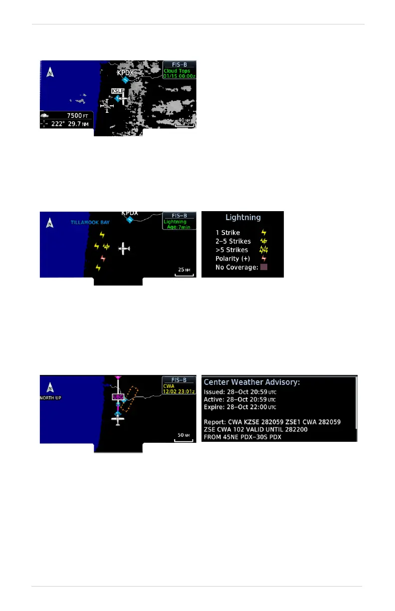
Cloud Tops
Lightning
Strike location is an estimate of its center. Lightning strikes display as a lightning bolt.
Center Weather Advisory
These advisories communicate en route and terminal weather conditions expected to
occur within the next two hours. Information is valid for up to 2 hours.
Indicates the altitude of the highest
visible portions of a cloud at the
time of forecast.
Cloud top data is generated by a
computer model and has limited
accuracy compared to actual
conditions.

Table of Contents

Other manuals for Garmin GPS 175

Questions and Answers:

Question and Answer IconNeed help?

Do you have a question about the Garmin GPS 175 and is the answer not in the manual?

Garmin GPS 175 Specifications

General IconGeneral
Display Resolution480 x 272 pixels
GPS ReceiverWAAS GPS
Receiver TypeGPS/WAAS
Display TypeColor TFT
MountingPanel mount
InterfacesRS-232, ARINC 429
Operating Temperature-20°C to +55°C
TypeAviation GPS Navigator
InterfaceRS-232
DatabaseObstacle, Terrain
CompatibilityCompatible with select autopilots

Related product manuals