- 80 -
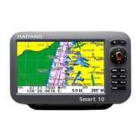
HIS-1000A
General specification
1. Display Screen: 10.2inch Color LCD with LED backlight
2. Resolution: WVAG (800 X 480 pixels)
3. Power Supply: DC 12V~36V(+-10%) 14W
4. Operating Temperature: -15°C~+50°C
5. Performance Standard: IMO Resolution MSC.112(73)
6. Option: MicroSD, External GPS Antenna, Remote control
GPS Receiver specification
1. GNSS Receiver Capabilities
GPS L1 C/A code
2. Number of Channel: 50 channels
3. Horizontal Positioning Accuracy
Autonomous 2.5m
4. Sensitivity
Acquisition -140 dBm
Tracking -149 dBm
5. Data Update Rate: 1 second
Chartplotter specification
1. Display Method: Mercado Projection
2. Display Mode: True motion / N/S/E/W up / Course up / Head up
3. Latitude Limits: Between 85
°
N to 85
°
S
4. Map Scale: 0.05nm to 1500nm
5. Map Datum: WGS-84
6. Waypoint: 30,000 points
*Total of 16 colors and 16 icons are selectable each point
with name tag (8 alphanumeric characters)
7. Track Point: 50,000 points( 2 types)
8. Route: Max capacity 100 Routes
*20 WPTs per each Route. Each with name tags
(8 alphanumeric characters)
9. Draw Point: 1,000 points
10. Area Name: 1,000 points
11. Chart Data: HY-MAP(Built-in or External)/ C-MAP
12. Output Data: NMEA-0183
13. Input Data: NMEA-0183
14. Alarm: Arrival, Anchor, XTE, Interval timer, User line
AIS specification
1. Connector VHF antenna(PI-259)
GPS antenna(BNC)
2. Frequency 156.025MHz ~ 162.025MHz
- Default channel 88B, AIS(162.025MHz)
- Default channel 87B, AIS(161.975MHz)
3. Channel Spacing 25KHz
4. Frequency stability rate
±
10RPM(-20
°C ~ +60°C)