14
InterfacingwithaGIS/Citymap
S
S
M
M
A
A
R
R
T
T
E
E
R
R
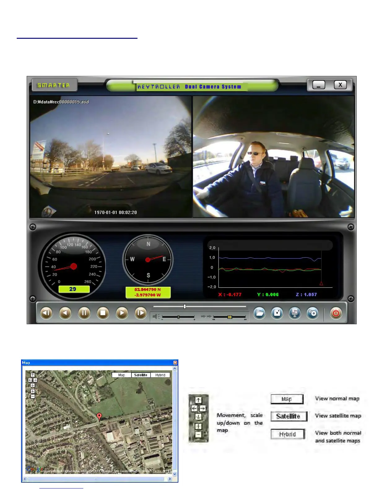
DriveRecordersimultaneouslyrecordstheGPSdatawhiledrivingsoyoucancheckthedriver’sroutestart—stoptimes,directionand
speedonthemap.ClicktheGIS/MAPicon()onthelowerrightcorner.Themapwindowappearsfortheusertoseethevehiclelocationandtravelonto
acitymap.
• Tousethisfunction,thesystemmustaccesstheInternet!!
When you click on the MAP icon at bottom right of screen, the vehicle position exactly synchronized with
the video is shown. You can choose, Google Map, Satellite (Earth view) or Hybrid (Earth with road names)