10.3
PDS Setup for WBMS, iWBMS, iWBMSh & iWBMSe
The WBMS GUI Version 10 Hotfix requires that Force Push be enabled in the WBMS GUI
Connection settings in order to receive data in PDS. Refer to section 4.6.5 for more information on
its functionality.
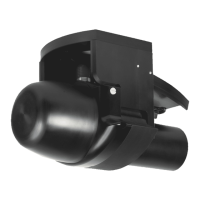
General instructions are provided for integrating NORBIT sensors. For sensors not supplied by
NORBIT, additional integration steps may be required which are not explained here. The setup
examples used in this section assume that an iWBMS, iWBMSh, or iWBMSe was installed in a
standard configuration.
Note that the PDS sign convention uses Y+ Forward, X+ Starboard, and Z+ Up. This is not the
same as the integrated Applanix systems on NORBIT sonars. Incorrect entry of the sign may corrupt
data.
The Applanix Ethernet groups required by PDS are automatically configured on integrated NORBIT
systems, thus no action is required. The required groups are: 1, 3, 7, 10, 12, 20, 102,
104, 111 and 113.
Offsets
By default, integrated NORBIT systems output all sonar and navigation data at the WBMS Reference
Point (refer to the Offsets section for more details). Therefore, PDS only requires the Sea Level
offset, Center of Gravity offset, and LiDAR offset if the optional iLiDAR is installed.
The Sea Level offset is used when depths are reduced using tide and heave. When RTK heights
are used for depth reduction, the Sea Level offset is only used for applying the sound velocity profile
at the correct depth.
CAUTION: For Integrated Systems, Sonar and INS Share Same Offset
By default, integrated NORBIT systems output all sonar and navigation data
at the WBMS Reference Point. Therefore, each device in the project setup
should have the same offset.
About the COR: The COR, for larger commercial vessels, is documented in the vessel design plans.
For other vessels, this point at which the vessel’s roll and pitch axes intersect need to be determined.
This is difficult to measure as the vessel CoR may change from day to day, and even during the day.
Generally, choose a CoR location that is about ¾ distance from bow to stern, centered on the keel,
and located at approximately water level. Especially for smaller vessels, the CoR moves depending
on fuel stowage and even distribution of personnel body weight. For example, two persons sitting
on the starboard rail of a 6m craft will move the CoR from the keel centerline a distance towards the
starboard rail. Choose a location and attempt to keep the weight distribution constant throughout the
survey. If in doubt, take the boat to open water and measure its motion while passing over waves in
different directions.