CHAPTER 7
50 Raven RS1™ Guidance and Steering Calibration & Operation Manual
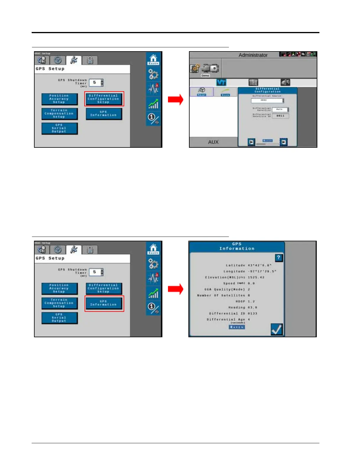
FIGURE 7. Differential Configuration Screen
4. Displays the GPS Differential Configuration options in the drop-down box:
•GL1DE
•SBAS
•Satellite GS
•RTK
NOTE: Depending on the number of feature unlocks purchased, all options may not be available for
selection. Contact your local Raven dealer to purchase additional unlock codes.
FIGURE 8. GPS Information Screen
• Latitude - The angular distance of a place north or south of the earth’s equator.
• Longitude - The angular distance of a place east or west of the meridian at Greenwich, England.
• Elevation (MSL) - The height of the antenna in reference to sea level.
• Speed - Current speed based on GPS measurements.
• GGA Quality (Mode) - The current convergence state of the GPS receiver.
◦ 0 = No Signal
◦ 1 = Converging
◦ 2 = WAAS Converged
◦ 3 = N/A
◦ 4 = RTK Converged
 Loading...