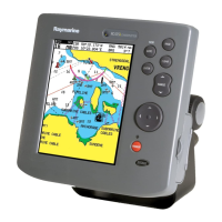
8.1 Chart application overview
The Chat application uses 2D perspective and
provides a variety of cartographic information
regarding your surroundings and charted
objects. The Chart application is pre-loaded
with LightHouse
™
, Navionics
®
and C-MAP by
Jeppesen
®
world base maps. Compatible electronic
charts can be used to expand the information and
detail regarding your surroundings and charted
objects.
1
Depth — Current water depth (only available with
transducer connected).
2 Navigation origin line — During navigation, shows
a solid line from the starting point to the target
waypoint.
3
Speed — Current vessel speed (shown in selected
system units).
4
Orientation — States the orientation mode that the
chart is using (North-up, or Course-up).
5
Range — Chart scale indicator (shown in selected
system units).
6
Vessel symbol— Shows your current position.
7
Vessel position line — During navigation, shows
a dotted line from the vessel’s current position to
the target waypoint.
8 Waypoint — Inactive.
9 Water temperature — When not in active navigation
current water temperature is displayed.
Distance to cursor/waypoint — During active
navigation the distance to the target is displayed.
Bearing and distance to cursor/waypoint —
During active navigation the distance to the target
is displayed.
10 Bearing — In motion mode the vessel’s current
COG bearing is displayed.
Cursor bearing and distance — In cursor mode
the bearing and distance to the cursor’s location,
from your vessel is displayed.
11
Waypoint TTG — During active navigation the
estimated ‘time to go’ to the target cursor/waypoint
based on your current speed is displayed.
12
Cursor — Used to select chart objects and move
around the chart area.
13
Target waypoint — Current target waypoint.
14 Vessel coordinates — In motion mode the current
vessel coordinates are displayed.
Cursor coordinates — In cursor mode the
coordinates of the cursor’s location is displayed.
The Chart application includes the following
features to help you navigate your vessel safely and
effectively:
Features
Using satellite-based
navigation.
•
6.4 Satellite-based
navigation
Planning with waypoints and
tracks.
• 8.4 Waypoints overview
• 8.5 Tracks
•
Navigating using waypoints
and tracks.
• 8.8 Navigation
Choosing electronic 2D
cartography.
• 8.10 Chart selection
• 8.2 Electronic charts
overview
– LightHouse charts
– Navionics charts
Backing up and transferring
Waypoints and Tracks.
• Saving user data and user
settings
Displaying COG vectors • 8.18 COG Vector
Viewing information for
charted objects.
• 8.20 Chart objects
Controlling the level of
information displayed on the
Chart application
• 8.11 Chart Detail
Altering the Chart
application’s orientation
to better suit your needs.
•
8.13 Chart orientation
Changing the boat symbol
position in the Chart
application.
•
8.15 Boat position
Changing the Depth at which
the Deep Water contour
changes color.
•
8.19 Deep Water
Note: To obtain full chart details, you must have
a cartography chart card for the appropriate
geographic area inserted into the card reader.
60
Dragony 6 / Dragony 7
 Loading...