160 | Appendix E - AIS connection for MX512 only
GPS satellite message. Thus, GPS plays a critical role in AIS, providing the universal time
reference as well as positioning data for each ship.
AIS data transmissions utilize a robust 9.6 kbps FM /GMSK (Gaussian Minimum Shift
Keying) modulation technique, which is specified in ITU Recommendation M.1371.1. The
International Telecommunications Union (ITU) has designated two dedicated frequencies
for AIS. They are 161.975 MHz (marine band channel 87B) and 162.025 MHz (channel
88B). In some parts of the world, such as the United States, where these frequencies
may not be available for AIS, other channels may be designated.
The MX535A transponder has two independent VHF receivers, which are normally tuned
to the two AIS frequencies, as well as one transmitter, which alternates its transmissions
back and forth between the two. It can also be retuned to other frequencies, for
instance when operating under the control of a shore-based VTS. This can be done either
manually or remotely by the AIS shore station.
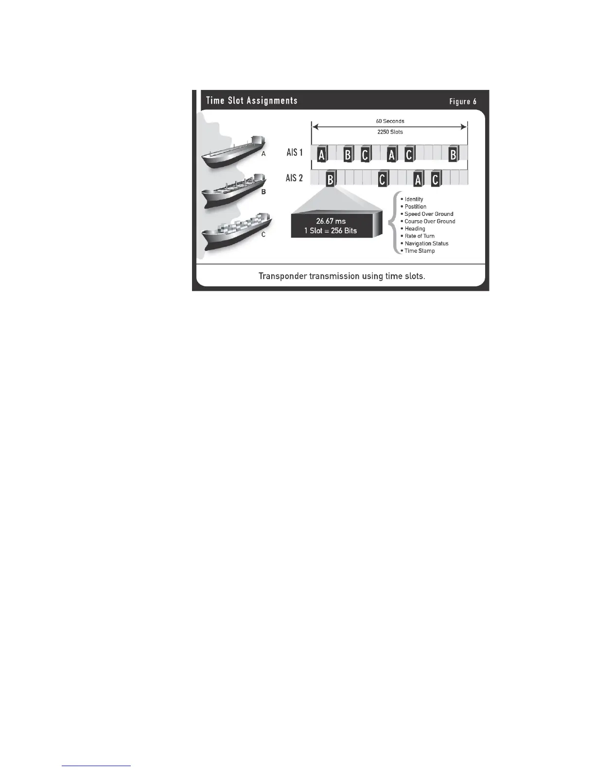
AIS Message
AIS is designed to work autonomously and continuously in a ship-to-ship mode, but
the specifications provide for switchover to an “assigned mode” for operation in an
area subject to a competent authority responsible for traffic monitoring, with the
data transmission intervals and timeslots set remotely by the shoreside authority.
Alternatively, the AIS can work in a “polling mode” in which the data transfer occurs in
response to interrogation from another ship or shore station.
Information provided by the AIS falls into several categories:
Static data
IMO number (where available)
-
Call sign and name
-
Ship’s name
-
Type of ship
-
Location of position-fixing antenna on the ship
-
(aft of bow and port or starboard of centerline)
-
Dynamic data
Ship’s position with accuracy indication and integrity status
-
Time in UTC
-
Course over ground
-
Speed over ground
-
Heading
-
Navigational status (e.g., “at anchor,” “not under command,”
-