_________________________________________________
Page 12
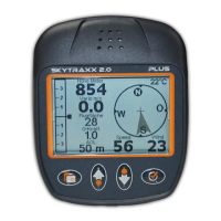
More about Height Calibration
A false GPS height indication will blink on and off. Once a signal is
established the value ceases to blink. The height is then calibrated.
The GPS height values are correct to within +/- 30 metres. With
poor GPS reception the inacuracy may be even greater. Where this
is the case, the height may be manually adjusted as follows:
In the main screen, pressing either one of the Minus/Plus keys will
open a new screen (see previous page). Use these middle keys
again to adjust the height in the direction indicated by the arrows
on the buttons. Note that 3D GPS reception overrides any
manually-entered height values which will automatically be
corrected whenever 3D GPS reception is available.
The GPS height is indicated on the DEVICE STATUS sreen.
Note that if logging is switched on the height can no longer be
manually adjusted.
If a height is indicated in the ELEVATION list using an appropriate
HGT file, Skytraxx then knows the height of the entire area and will
also use this height information when no 3D GPS reception is
available. The hgt File contains the topography data.
Points to remember
The Main Screen is the default screen-setting after start-up.
After reciept of a 3D GPS signal, and whilst viewing the Main
Screen, logging can be toggled on and off by holding down the OK
key. Confirm each time by again pressing OK or exit by pressing
Menu.
Logging starts the flight time chronometer.
 Loading...