_________________________________________________
Page 9
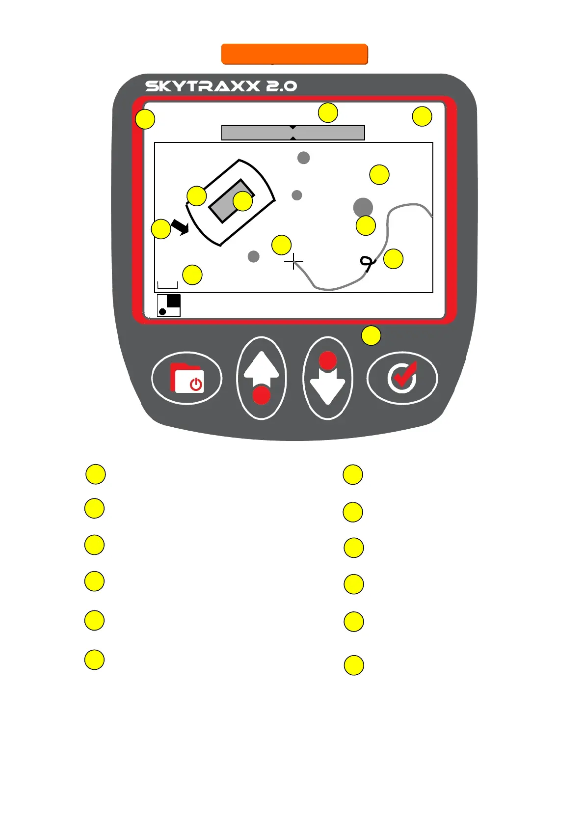
1
Airspace within warning distance
2
Airspace warning distance
3
Wind
9
Track
4
Scale
5
Distance to next airspace
10
GPS Height AMSL
6
Track log
11
Current position
8
Groundspeed
7
Waypoints
1740
42
7.4 km
5
NW/16
+ Kandel
14.2 km
+ Hintereck
7.9 km
+ Tafelbühl
19.8 km
W
NW
SW
2
3
4
11
1
5
7
8
9
10
6
A short press on the Minus/Plus keys changes the scale. Holding either one
down displays Airspace information. Further pressing scrolls through the
information. Press Menu to exit back to Map. See next page for more details.
12
Thermal source
12
Map screen
Map screen
480m