P/N 95B-6131-00 (April 2022) RiverRay Deployment Guide
Page 14
EAR-Controlled Technology Subject to Restrictions Contained on the Cover Page.
Locating the Start & Stop Positions
L OCATING THE START AND STOP POSITIONS INCLUDES THE FOLLOWING
STEPS
:
Locating the Start and Stop Positions
Locating the Start and Stop Positions
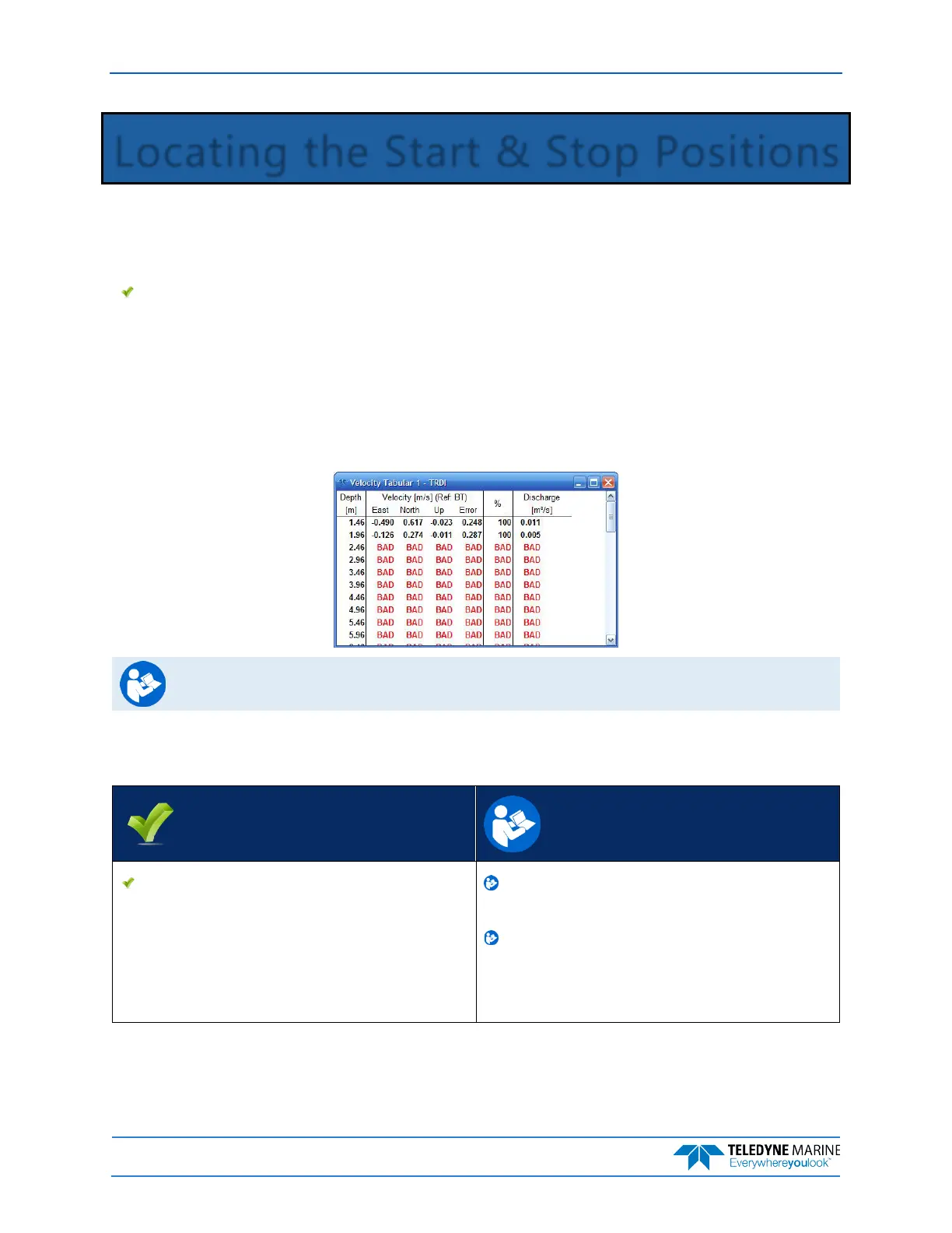
While the RiverRay is pinging, the Hydrologist positions the boat until the application shows that the Ri-
verRay is reliably collecting at least two bins of data and marks the position on the tagline for future refer-
ence. Measure the distance to the shore from the RiverRay. The RiverRay is positioned to the opposite
bank where two bins of data are reliably collected. Again, the tagline is marked and the distance to the
shore from the RiverRay is measured.
See Chapter 3 Tutorials and Chapter 10 Acquiring Discharge Data in the WinRiver II User’s
Guide.
Quick Review
Locate the Start and Stop Positions Read Chapter 3 and Chapter 10 in the
WinRiver II Users Guide.
Start/Stop distances from the center of
the transducer to the shore should be
measured as accurately as possible - at
least to the nearest deci-meter.