User’s Manual – GPS Mode
200
G
r
e
e
n
w
i
c
h
M
e
r
i
d
i
a
n
E
q
u
a
t
o
r
φ
λ
X
Z
h
Coordinate Systems
A coordinate system is a way to describe positions in a datum.
Coordinate systems range from simple Cartesian (y,x) or (N,E)
positions on a flat plane to complex geodetic latitudes and longitudes
on a reference ellipsoid.
Below is a description of some coordinate systems common in
surveying:
• Northing, Easting, Elevation
Survey projects usually use simple plane coordinates. You assume
your local datum models a flat earth, and you calculate coordinates in
a Cartesian system where the simple laws of plane trigonometry
apply. When a vertical coordinate is required, most survey projects
require orthometric elevations.
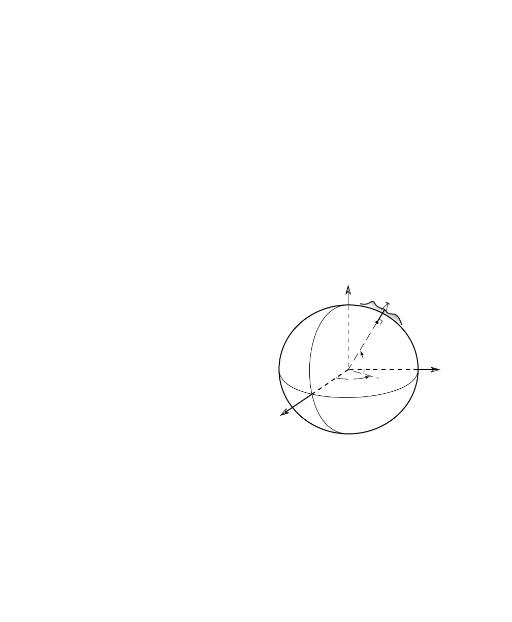
• Lat, Lng, Ht
Geodetic horizontal coordinates are usually
expressed as two angles called latitude and
longitude (φ, λ). Geodetic vertical coordinates
are usually expressed as the distance above the
ellipsoid called height. The angles describe a
point’s position on the surface of the reference
ellipsoid. The height describes the altitude
normal to the surface of the reference ellipsoid.
Fig. 1: Ellipsoidal Geodetic
Coordinates