MAVIC 2 ENTERPRISE Advanced
User Manual
©
2021 DJI All Rights Reserved.
51
waypoint. The settings are applied to the selected waypoint including aircraft speed, height, yaw,
longitude, latitude, and waypoint type and actions.
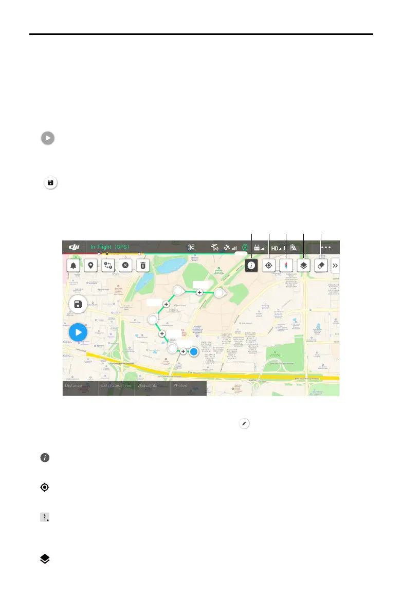
8. Mission Information
Displays the ight length, estimated ight time, waypoint quantity, photo quantity, longitude, and
latitude.
9. Perform
: tap and check the settings and status of the aircraft in the pop-up checklist. Tap Start to Fly
to perform the mission.
10. Save
: tap to save current settings.
Waypoints Editing
Enter the mission library, select a created ight route, and tap to edit the ight route.
1. Flight Restriction Information
: tap to view the ight restriction information.
2. Location
: tap to center the map around the location of the aircraft.
3. Map Lock
: map rotation is locked by default with north at the top of the map. Tap to unlock rotation.
Hold two ngers on the map and rotate to adjust the orientation.
4. Map Mode
: tap to switch between Standard and Satellite modes.
24.8m
54.8m
58.8m
54.8m
GPS
12
2.4G
21 3 4 5
 Loading...