MAVIC 2 ENTERPRISE Advanced
User Manual
56
©
2021 DJI All Rights Reserved.
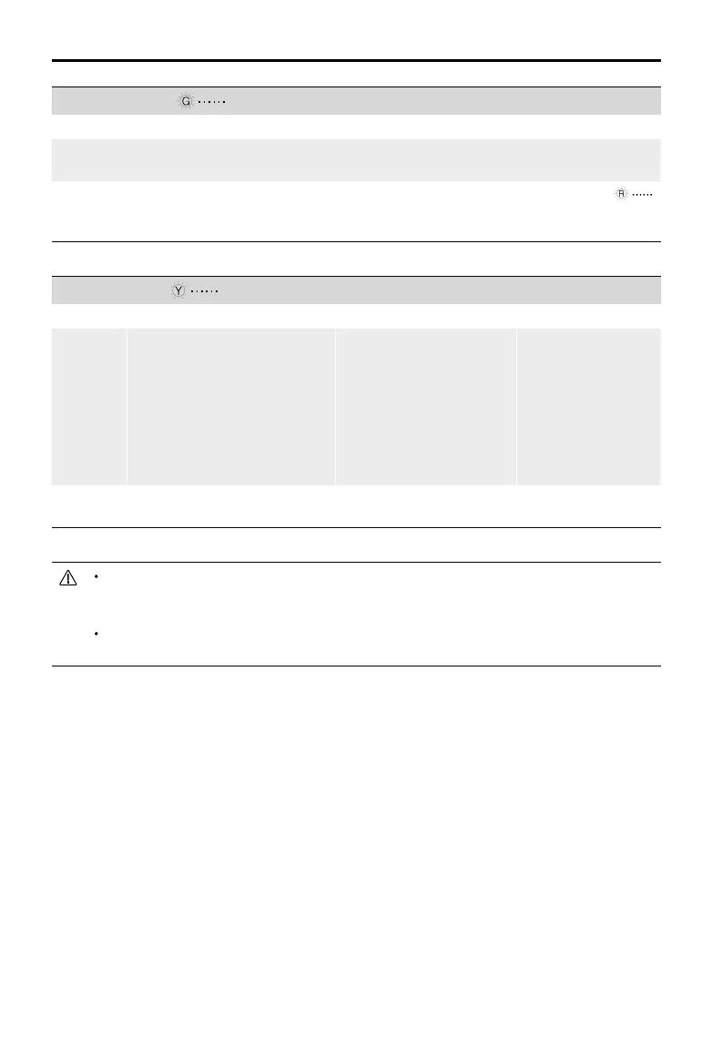
GPS Signal Strong Blinking Green
Flight Limits DJI Pilot App Aircraft Status Indicator
Max
Altitude
Altitude of the aircraft cannot
exceed the specied value.
Warning: Height limit
reached.
N/A
Max
Radius
Flight distance must be within
the max radius.
Warning: Distance limit
reached.
Blinks red quickly
when close to the max
radius limit.
GPS Signal Weak Blinking Yellow
Flight Limits DJI Pilot App Aircraft Status Indicator
Max
Altitude
Height is restricted to 16 ft (5
m) when the GPS signal is weak
and Downward Vision System is
activated.
Height is restricted to 98 ft (30
m) when the GPS signal is weak
and Downward Vision System is
inactivate.
Warning: Height limit
reached.
N/A
Max
Radius
No limit
If the aircraft reaches one of the limits, users can still control the aircraft, but cannot y it any farther.
If the aircraft ies out of the max radius, it will automatically y back within range when the GPS
signal is strong.
For safety reasons, do not y close to airports, highways, railway stations, railway lines, city centers,
or other sensitive areas. Only y the aircraft within visual line of sight.
GEO Zones
All GEO Zones are listed on the DJI ocial website at http://www.dji.com/ysafe. GEO Zones are
divided into dierent categories and include locations such as airports, ight areas where manned
aircraft operate at low altitudes, international borders, and sensitive locations such as power plants.
 Loading...