14
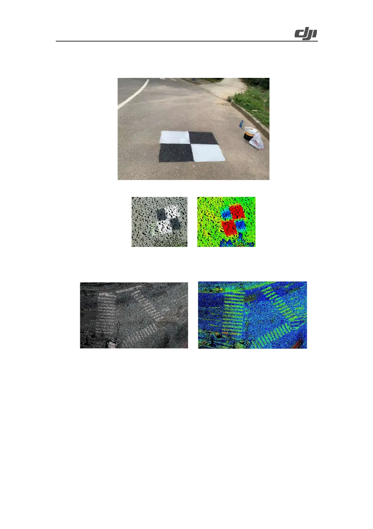
coordinate measurement, you are advised to use the visible-light display mode to roughly locate
the checkpoints and then switch to the reflectivity display mode to accurately measure the
coordinates of the checkpoint centers.
Figure: Field checkpoint layout
Figure: Checkpoint icons in the point cloud result (left: visible light; right: reflectivity)
In addition, if a zebra crossing or another object with sharp reflectivity differences exists in
the mapping area, the object's corners can be set as checkpoints.
Figure: Zebra crossing icons in the point cloud result (left: visible light; right: reflectivity)
3.1.1.2.2. Elevation Checkpoints
With DJI Terra used for accuracy check, the aircraft can output an elevation accuracy report, with
a focus on the Root Mean Square Error (RMSE) indicator. Note that this type of software only
checks the elevation accuracy but does not generate any plane check reports. The basic principle
of elevation check is explained as follows: Take the 3D position of the checkpoint as the center,
calculate the weighted mean elevation of the 3D points around it in a certain range, and then
calculate the difference between the weighted mean coordinates and the measured coordinates.
This test method assumes that the LiDAR's plane error can be ignored, and that the points near the
checkpoint are all on roughly the same elevation plane.
Therefore, when laying out elevation checkpoints in the field, you can choose a flat ground area of
 Loading...